288 results
Geography classroom decors for Microsoft Word
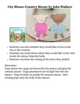
City Mouse Country Mouse Craft
This craft and writing piece is ready for the photocopy machine. Students can vote where they would like to live after listening to the Aesop's Fable version by John Wellner. Then they can make their mouse and draw the setting along with their writing. The final mice crafts can be used as a bulletin board or graphed to compare.
Subjects:
Grades:
PreK - 1st
5th Grade State Report and Poster (Google Slides)
This is a complete packet for 5th grade State Reports. A parent letter is included, as well. Students will use Google Slides to create their report and a hand made poster (directions included) is required.
Grades:
5th
Types:
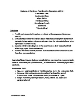
Features of the Ocean Floor Creative Illustration Activity
Wish I would have thought of this idea years ago because I always had a hard time teaching the features of the ocean floor without it being boring. Hope you enjoy! Did it this year for the first time-loved the results. 11/11/2015
Includes very creative ideas for visuals relevant to each feature of the ocean floor...For example, students may draw NEMO going to touch the "butt" (boat) at the drop off (continental slope)
I have provided several very cool examples for each feature of the ocean fl
Subjects:
Grades:
1st - 6th
Types:
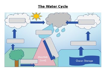
The Water Cycle Worksheet and Answers
This activity works well when projected onto a whiteboard and writing in the answers together with the class while discussing the purpose of each part of the Water Cycle. Answer sheet is included.
Activity can also be used for assessment of knowledge of the Water Cycle.
Answers sheet can be printed out and used as a poster for the classroom.
Subjects:
Grades:
4th - 12th, Adult Education
Types:

Planning A Road Trip Project
This project requires students to plan a road trip within the United States. It covers many aspects of Geography (using roads, directions, finding attractions, etc.) and requires use of Mathematics for budgeting.
Students will plot out the cities they plan to go to, the hotels they will stay at, the attractions they will visit, and miles driven. They will also write journal entries and create a postcard from one of their cities.
They will use actual prices (computers will be needed for resear
Subjects:
Grades:
7th - 8th
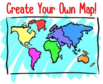
Create Your Own Map! Project & Rubric
In this project students get to become Map Makers! They use their knowledge of Maps to create their own unique map. Included in this product is a "Creating a Map: Rubric", a "Map Brainstorming & Planning Sheet", project directions for students to follow, and photos of students' work to use as a guide/example. This product was made in a Microsoft Word document and is easy to edit in order to meet your individual classroom needs. 5 Essentials of a map include (in no particular order):1. Title
Grades:
4th - 7th
Types:
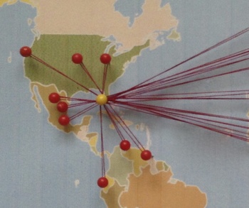
Celebrate Diversity - Where Are We From? Bulletin Board Map/Activity.
Where Are We From?
This fun activity plots locations on a bulletin board map for the whole class to see. It is great for representing cultural diversity in the classroom. Ask students about their culture and ancestors and then plot data for all to see in a unique way. This product includes a material list, directions, tips, and a sample worksheet.
The activity and the corresponding bulletin board decoration can be used in a variety of ways. It can be an opening of the year icebreaker and
Subjects:
Grades:
4th - 12th
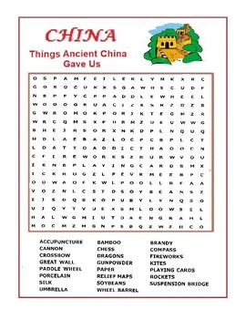
China Word Search Puzzle - Things Ancient China Gave Us - Wordsearch
A word search list of contributions of China to the world. Silk, Umbrellas, Fireworks, Paddleboats, Cannons, Chess, Kites, Rockets, Crossbows, Gun Powder …..etc. People who likes this worksheet also liked the one on Rome and Egypt.
Grades:
4th - 12th
Types:
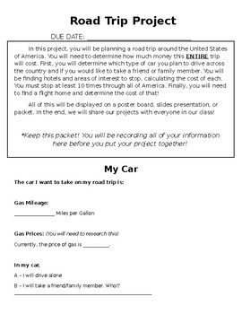
ROAD TRIP PROJECT
This Road Trip Project is meant for middle school math students, but can be changed for younger or older.
In this project, students must choose ten places to stop at around the United States of America. At each stop, they need to go to at least one attraction and stay at a hotel. They need to calculate the cost to visit each location and the cost of travel, keeping in mind the mileage for the vehicle they choose.
This purchase includes a full description of the project, tables for students to
Subjects:
Grades:
5th - 10th
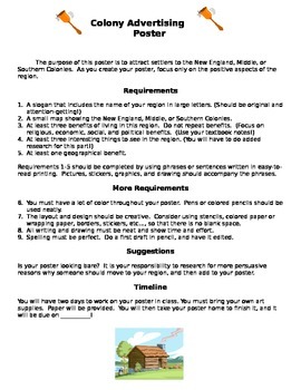
Colonial Region Advertising Poster Project
Need an engaging culminating project for a study of Colonial Regions? This project allows students to present their learning in a creative manner. They present their research on colonial regions by creating an advertising poster for that region. Can be used an a individual or group project. Score sheet is included.
Grades:
5th - 8th
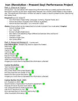
Iran Research Project w/ Poster (Revolution - Present)
Iran research project with poster requirements included. Steps 1-2 are required research. Step 3 has topics for students to choose from to research. Step 4 is the poster requirement. Step 5 is a Gallery walk with questions attached for student feedback.Include examples of finished poster.
Subjects:
Grades:
9th - 10th
Also included in: Geography & History of the World Research Projects (4 Total)
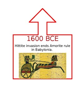
Ancient World History Timeline
This timeline was created for a 6th Grade Ancient World History class that utilized DBQs as part of instruction. Dates in CE are blue, BCE are red, and when the event spanned both they are purple. An arrow is at the top of the box to help signal where on the line the event took place. I used duct tape to create my line and pinned the events as we learned them during the school year. This was a great visual display for my students and helped them understand how different parts of the world were c
Subjects:
Grades:
5th - 12th
200+ Premade Geography Terms for Word Wall + Blank Strips to Make Your Own
121+ Geography term for use of a Word Wall + blank strip for extra words. Font: 39 SmoothAbsolute locationAccessibility resourceAcculturationAcid rainActive volcanoAgricultureAltitudeArchipelagoAshAtlasAtmosphereAxisBayBedrockBiosphereBirth rateBoundaryButteCanalCapeCapital goodsCapitalismCardinal directionsCarrying capacityCartographerCinder coneClimateColonialismCommand economyCommercial farming CommunismCompass roseGeographyConiferousConstitutional monarchyConsumerContinentContinental climate
Grades:
6th - 12th
Types:
Also included in: Build A Bundle for Georgianne B
World Geography — Five Themes of Geography Word Wall
Add these creative and aesthetic cards to your vocabulary geography word wall while teaching the five (5) geographical themes. Vocabulary word wall cards assist in vocabulary development. The cards should be used as an instructional tool for teachers and then as a reference for all students, particularly English learners and students with disabilities. Each card consists of a word, definition, and related image: Location: Absolute and Relative LocationPlace: Human Characteristics and Physical Ch
Grades:
5th - 12th
Types:
Also included in: Bundle for Brittany G.
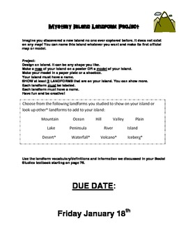
Mystery Island Project Instructions - Landforms
Imagine you discovered a new island no one ever explored before. It does not exist on any map! You can name this island whatever you want and make its first official map or model.
Use These set of Instructions for a Project Assignment with your LANDFORM Unit. I used this for my second grade class. It requires them to create an island that they discovered. They must name it according to its shape. They can get very creative with this. I have made an example of a final project: "Shark Island" in
Subjects:
Grades:
K - 5th
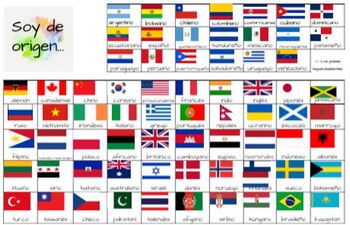
Soy de Origen - Spanish vocabulary chat mat for countries and nationalities
Soy de Origen Spanish vocabulary chat mat - This resource is sure to get your students talking about their nationalities and the nationalities of others. I put this chat mat on each table and students use it to converse about their own nationalities and the nationalities of famous Spanish-speaking people. There is a separate section at the top of the chat mat that lists the Spanish-speaking countries.
Subjects:
Grades:
6th - 9th
Latin Language Project - States' Mottos
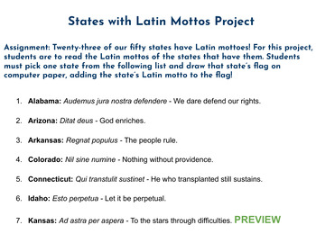
Assignment: Twenty-three of our fifty states have Latin mottoes! For this project, students are to read the Latin mottos of the states that have them. Students must pick one state from the list and draw that state’s flag on computer paper, adding the state’s Latin motto to the flag!This product comes with a downloadable word document with a list of all the states that have Latin mottos. Images of state flags can easily be found online and printed out, if desired. This is a great, fun assignment
Subjects:
Grades:
4th - 8th
World-wide Kids - Editable Labels - Multi-cultural Theme
These labels will help you create a cheerful and organized learning environment with a multi-cultural theme. This set includes a various label formats (two-, three-, and four-per-page) PLUS twelve different children holding white-boards. Add your own text to these labels (and edit text format) as you wish. This file is a Microsoft Word document.
These labels match additional coordinating products here in my store:
Kids & Countries Multi-Cultural Music Borders
Multi-Cultural Music Kids and N
Subjects:
Grades:
PreK - 6th
Wall-E Re-Storation Overpopulation Pollution Project - Editable
This project was designed to meet part of the C3 framework for Social Studies. After watching the movie Wall-E, and filling out the movie guide, students worked on this project. It is a great way to bring together population, climate change, and environmental sections in World Geography. This document is editable.
Grades:
6th - 8th
AP Human Geography Agriculture Project
This is a project that aligns with the Agriculture unit of AP Human Geography. This traces the evolution of agriculture through the different time periods, assessing the positives and negatives and specific types of farming included.
Subjects:
Grades:
9th - 12th
Types:
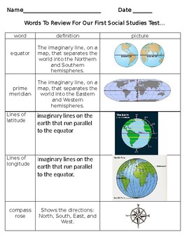
GEOGRAPHY STUDY GUIDE- Maps, Latitude, Longitude, ETC. ETC
This is used as a reference guide for students during out first geography unit. This is also used as a study packet. Finally, I use this on my Social Studies word wall. I simply enlarge the wording, print in color, laminate, and cut out.
COMPLETELY EDITABLE. You can add anything you include and I missed OR remove any items you do not wish to cover. ENJOY!
The following terms are included in this packet:
equator
prime meridian
lines of latitude
lines of longitude
compass rose
globe
map
map ke
Subjects:
Grades:
2nd - 6th
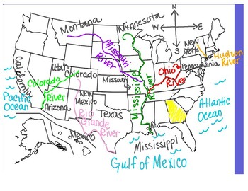
U.S. Rivers and Mountains Map
This is a diagram using a U.S. map with each different U.S. river and mountain range taught in 3rd grade Social Studies labeled and color-coded. The corresponding border states and oceans are labeled as well, along with a compass rose to help practice the important skill of compass directions . This is ideal to project on a Smart Board during a lesson.
Subjects:
Grades:
3rd
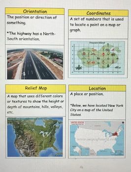
Passport Unit 1 Vocabulary Cards
Vocabulary cards based off the social studies grade 3 Passport curriculum. Cards include definition and picture. Recommended to print in color, and great for laminating and using on word walls! * 8 pages* 31 vocabulary cards
Subjects:
Grades:
2nd - 5th
Types:
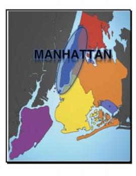
Map, New York, 5 Boroughs
Each page of this document includes a map of NY with a variety of places highlights:
- 5 Boroughs
- Hudson River
- East River
- Atlantic Ocean
Great for labeling student tables for a unit and/or handing out to study maps.
Grades:
K - 12th, Higher Education
Types:
Showing 1-24 of 288 results


