1,178 results
1st grade geography assessments
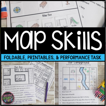
Map Skills Worksheets & Performance Task | Print & Easel
Practice using a map key, a compass rose, and a scale to read, interpret, and create basic maps! These printables are perfect for teaching geography or quick map skills assessments in first grade, second grade, or third grade! The following print-and-go map skills activities are included:Map Vocabulary Foldable: Students cut along the dotted lines to create three flaps and then fold along the solid line. Under each flap, students define the vocabulary word shown on the top of the flap. Words inc
Grades:
1st - 3rd
Types:
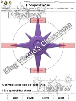
Compass Rose Cut and Paste Activity - Cardinal Directions - Map Skills
Compass Rose Cut and Paste Activity - Cardinal Directions - Map Skills - King Virtue's ClassroomStudents will love applying what you've taught them about maps with this engaging cut and paste activity. This activity will help them review the compass rose and cardinal directions (north, east, south, and west).This set includes:1 cut and paste activity1 answer keyEnjoy!:)Copyright © King Virtue’s Classroom • www.kingvirtuesclassroom.com • All rights reserved.
Grades:
K - 2nd
Types:
Also included in: Social Studies MegaBundle - King Virtue's Classroom
Georgia Regions and Rivers Unit**Includes Virtual Field Trips for ALL Regions
A perfect unit to assist in teaching Georgia Regions and Rivers in 2nd grade! Complete with word wall words, interactive notebook pages, interactive mini book, quizzes, sheets, final assessments, PLUS an end of unit activity and interactive website to review the Georgia Regions!Also included in the ZIP file: Rivers Powerpoint and Top-Seller: Ga Regions Videos! * Clip art: www.englishunite.com* Frames: Winchester Lambourne* Borders: Creative Clips* Backgrounds: steach4fun* Fonts: Found on Google
Grades:
1st - 3rd
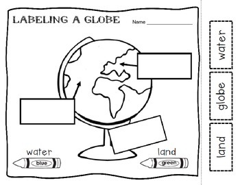
Maps and Globes Introduction
This is a printable where students identify the difference between maps a globes. They must label the land and water. There is a venn diagram to assess the basic similarities and differences of maps and globes.
Thanks and happy teaching!
Subjects:
Grades:
K - 2nd
Types:
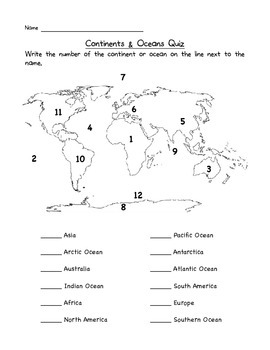
Continents & Oceans Quiz
This is a great way to check that your students know the locations of the seven continents and five oceans.
Test, Quiz, Exam, Check up, Assessment
North America
South America
Europe
Asia
Africa
Australia
Antarctica
Atlantic
Pacific
Indian
Arctic
Southern
Subjects:
Grades:
1st - 4th
Types:
Map Skills for Kids
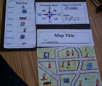
This six-page document contains blank copies of a town map, a compass rose, map title, and map key. Students will demonstrate their understanding of cardinal and intermediate directions when filling out the compass rose. Students can show their creativity when coming up with a map title and map key symbols. The map key includes symbol words and then the students can draw their own symbols. Then students place their symbols on the map. An example of a students finished map can be seen in the
Subjects:
Grades:
PreK - 6th
Types:
Baseball Math and ELA Activities
Looking for baseball math, reading, and word study activities? Our Baseball Activities include resources addressing skills such as compound words, fact and opinion, word study, map skills, word problems, story elements, and more! (Includes 13 specific resources below.) Let us help you plan an entire day of learning that is centered around the sport of baseball!1) Baseball Acrostic: Students plan and write an acrostic poem about baseball. (planning page and primary and intermediate lined paper
Subjects:
Grades:
1st - 3rd
Types:
North America Map - U.S. - Blank - Full Page - Continent - Portrait
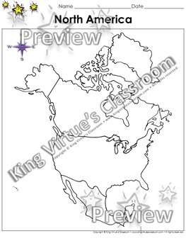
North America Map - United States Outline - Blank - Full Page - Continent - Portrait - King Virtue's ClassroomWorking on your Map Skills unit? This map is the perfect resource for you! Use it to review this continent from the world map with your students.This set includes:1 map sheetEnjoy!:)Copyright © King Virtue’s Classroom • www.kingvirtuesclassroom.com • All rights reserved.
Subjects:
Grades:
K - 5th
Types:
Also included in: Social Studies MegaBundle - King Virtue's Classroom
Map the Classroom Geography Prepositional Map Making
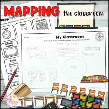
This pack contains a fun geography activity that students love - mapping their own classroom! My students have always enjoyed this activity and it's a great way to design a classroom map with cut out and paste features such as desks, chairs and whiteboards. Student can also practice their compass directions with the matching activity sheets. Draw a map and learn about geographic features in map-making. A fantastic way to build upon prepositional language and early mapping skills.SAVE 30% by buyi
Grades:
K - 2nd
Types:
CCSS:
Also included in: Mapping Skills Bundle
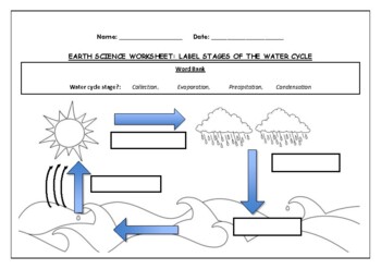
Earth Science worksheet: Label stages of the water cycle
Earth Science worksheet: Label stages of the water cycle2 VERSIONS OF WORKSHEET (Worksheet with a word bank & Worksheet with no word bank)Students have to label the stages of water cycle by looking at the diagram (Evaporation, Collection, Precipitation and Condensation)Students can color in the pictures they are doneWorksheet aimed at higher kindergarten/lower primary levelAnswer Key includedBoth PDF and Editable Word Versions included within the ZIP file
Subjects:
Grades:
K - 6th
Types:
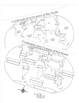
7 Continents and 5 Oceans Blank Map and Answer Key Map
Two sheets designed to help kids practice and teacher's assess the basics of geography. Can you label the map with 7 continents and 5 oceans?
Subjects:
Grades:
K - 5th
Types:
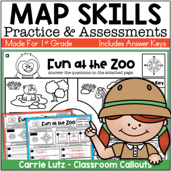
First Grade Map Skills Worksheets / Reading a Map Assessments
Do you need Map Skills practice and assessments for your first graders? You can choose from 5 different locations for your students to practice these social studies skills. Map Key, Compass Rose, Cardinal Directions, and Relative Directions. You get maps from these 5 locations:On the FarmOn the IslandAt the ZooAround Town At the CampsiteEach Set has these skills:The Compass RoseThe Map KeyCardinal Directions ( Go south to get to the....)Relative Directions ( The ____ is east of the ___.)Direc
Subjects:
Grades:
1st - 2nd
Types:
Also included in: First Grade Map Skills Activities Bundle
New South Carolina Social Studies 1st Grade Unit 2: All About Maps
This unit is just what you need to teach the new South Carolina social studies standards for 1st grade.Unit 2: All About Maps After this unit, students will be able to apply map skills as they identify and describe the location of South Carolina in relation to the rest of the United States. This unit introduces landforms and water ways to build background knowledge for 1st grade unit 3.The unit includes:-10 lesson plans-recommended read alouds-video links-student handouts -a slide show for each
Subjects:
Grades:
1st
Types:
Also included in: 1st Grade Social Studies Bundle-New South Carolina Standards
![Preview of Classical Conversations POPCORN Review Game [Cycle 3 Weeks 1-12]](https://ecdn.teacherspayteachers.com/thumbitem/Classical-Conversations-POPCORN-Review-Game-Cycle-3-Weeks-1-12--3387353-1658953372/original-3387353-1.jpg)
Classical Conversations POPCORN Review Game [Cycle 3 Weeks 1-12]
CC kiddos have a ton of fun with this review game whether it's played during Community Day with their friends OR at home during independent play! Questions cover material from Weeks 1-12: timeline song, English grammar, science, history sentence, skip counting, Latin, and geography. Each question card is labeled with the week so that the Classical Conversations flashcard ring can be quickly and easily used to check for correct answers. Check out the preview for a more detailed look. Click HERE f
Subjects:
Grades:
1st - 4th
Types:
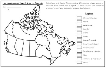
French Map of Canada and Capitals - La carte du Canada et les capitales
Includes two French maps of Canada so your students can learn the provinces, territories and capitals of Canada.Map one teaches students the location and names of all the provinces and territories of Canada. Map two teaches students the provincial and territorial capitals of Canada. Perfect for visual learners! Sized for Tabloid paper (11x17) but can be printed on regular printer size as well.Perfect for FSL, immersion or francophone students!Also available in English: Map of Canada and Capitals
Subjects:
Grades:
1st - 6th
Types:
BUNDLE Map Skills with Georgia Regions & Rivers
GA 2nd Grade Social Studies Standards:
SS2G1 The student will locate major topographical features of Georgia and will
describe how these features define Georgia’s surface.
a. Locate all the geographic regions of Georgia: Blue Ridge Mountains, Piedmont,
Coastal Plain, Valley and Ridge, and Appalachian Plateau
b. Locate the major rivers: Ocmulgee, Oconee, Altamaha, Savannah, St. Mary’s,
Chattahoochee, and Flint.
Students will create their own map of Georgia's regions, creating patterns to fill
Subjects:
Grades:
1st - 3rd
Types:
Map Skills Unit {Canadian Version}
***This is the CANADIAN Version of my Map It Out unit**Map It Out the Canadian Version is a map skills unit full of ideas, posters, task cards, activities, and more to help teach your students how to use different maps!18 Posters with pictures and definitions:EquatorHemisphereLatitudeLongitudeKey/LegendCompass RoseCardinal DirectionsIntermediate DirectionsGlobeMapPopulation MapGrid MapScaleContinentCountryProvinceTerritoryCityActivity Pages With Answer Keys:-Using A Map Key-Using A Map Key: Brit
Grades:
1st - 3rd
Types:
Map Skills - Performance Tasks
Maps performance tasks! Here are two performance tasks that I created and used with my first grade students when we completed our unit. We actually did a practice run creating a map of our classroom early in the unit so they had experience doing something very similar to this. Updated with new BW graphics and fonts. Students get to name their own farm and playground to create the maps. They really did a great job with these and most were easily able to show Proficiency. For each map, I gave t
Subjects:
Grades:
1st - 2nd
Types:
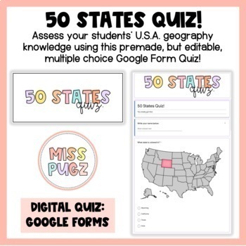
50 States Quiz: Google Forms!
Assess your students’ U.S.A. geography knowledge using this pre-made, but editable, multiple choice Google Form quiz! Students will see an image of the United States map and will be asked to identify the state that is colored in. This quiz is:Multiple Choice Has points already inputtedCorrect answers are pre-selected: NO grading for YOU! Google Forms will grade each quiz for you and you can easily upload students' scores to Classroom. Just upload to Google Classroom and use it as a review, a fin
Grades:
1st - 5th
Types:
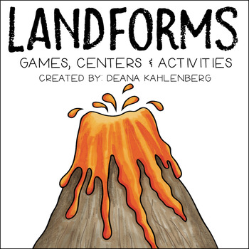
Landforms
This colorful pack has lots of games, centers and activities to learn about 14 different landforms. Landforms include: canyon, plateau, beach, island, river, valley, mountain, volcano, waterfall, lake, pond, hill, glacier and cave. The pack was created for 2nd grade social studies but could be used for science as well. Be sure to check out the preview!Page 1: Title PagePage 2: Product DescriptionPage 3: Table of ContentsPage 4-20: Landform Reference Cards/Booklet (in color and black/white)Page
Subjects:
Grades:
1st - 4th
Types:
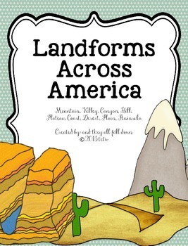
Landforms Across America
This unit focuses on only these 10 land forms:
Mountain
Valley
Canyon
Hill
Plateau
Coast
Desert
Plain
Peninsula
Bay
Each land form has at least 9 pages that go with it:
Pages included on each landform:
a reading comprehension sheet (non-fiction),
comprehension questions (2 forms)
flip books (2 forms)
a display poster with vocabulary definitions
vocabulary flash cards
vocabulary sheet
vocabulary poster sheet
Map of the U.S. for students to locate where each landform is located.
Map of the
Grades:
K - 4th
New SC Social Studies 1st Grade Unit 3: Postcards from South Carolina
This unit is just what you need to teach the new South Carolina social studies standards for 1st grade.Unit 3: Postcards from South Carolina After this unit, students will be able to apply map skills as they identify and describe the location of South Carolina in relation to the rest of the United States. Students will learn the difference between rural, suburban, and urban areas in South Carolina. They will also describe and compare different landforms within South Carolina. The unit includes:-
Subjects:
Grades:
1st
Types:
Also included in: 1st Grade Social Studies Bundle-New South Carolina Standards
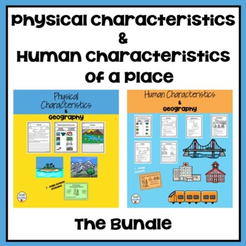
1st Grade: Physical and Human Characteristics of a Place
Engage your students as they learn about the physical and human characteristics of a place plus save with this money saving bundle.By purchasing this bundle, you will save 20% off the total value of the individual products.*Please click on each resource above for more details.Also, follow me and be notified when new products are uploaded. Make sure you click the green star which can be found by the name of my store. As always, thank you for your business!
Subjects:
Grades:
1st
Types:
CCSS:
Social Studies Assessments 1-2 Grade
These assessments are given to first grade-second grade students to determine how well each student has mastered each unit. Assessments are aligned to the new Essential Standards for Social Studies and reinforce teaching the standards to their intended level. (Maps, Constitution Day, Goods and Services, Community Helpers, Florida, Map key, Map Legend, Timeline, Holidays, Continents and Oceans, Symbols of Our Country, United States Flag, Branches of Government, Needs and Wants)There are 13 Social
Grades:
1st - 4th
Types:
Showing 1-24 of 1,178 results

