197 results
Geography classroom decors for staff
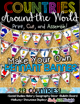
Countries Around the World Classroom Decor Make Your Own Pennant Banner
Worldwide Countries Classroom Decor Make Your Own Pennant BannerGrades K-12 social studies, history, geography, Model UN, global studies, world history Celebrate our world! Teachers can decorate their classrooms, hallway, gymnasium, media center, or anywhere in their building. You'll get 213 pennants to choose from. Pick pennants that represent your student's heritage, ethnicities, backgrounds, ancestry. They are colorful and awesome to look at. The countries pennant will bring enthusiasm and un
Grades:
PreK - 12th, Higher Education, Adult Education, Staff
Also included in: English Teacher Activities and Fun Bundle
Social Studies Mega Bulletin Board Bundle
This Mega Bundle includes ALL of my best-selling Social Studies Bulletin Boards!"Be an Upstander" Interactive Bulletin BoardThis resource is appropriate for middle and high school students. 30 cards are included in this resource including terminology (stereotypes, prejudice, discrimination, bystander, upstander, change agent, implicit bias), 12 quote/task cards from upstanders in history, and more!An instruction sheet with teaching tips and "Upstander Response Cards" are also included in this re
Subjects:
Grades:
6th - 12th, Higher Education, Staff
Map Print Bulletin Board Letters
There's so much you can do with this 70 piece Map Letter Clip Art Set - both digitally and in print form! They are perfect for bulletin board letters! Perfect for social studies and history classes! They're also great to liven up any resources you might create!Included in the download are:* 26 capital letter images* 26 lower case letter images* 10 number images* 8 symbol imagesAll 70 images are 300 dpi / on transparent background so you can resize them any way you'd like without losing clarity!T
Grades:
Staff, Not Grade Specific
Also included in: Bulletin Board Letters Growing Bundle
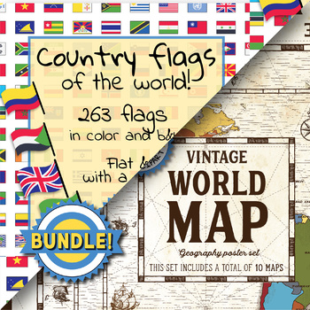
Country flags of the world & World map and continent - School Clip Art - BUNDLE
BUNDLE! Country flags of the world & World map and continent Product #1: Link to the productCountry flags of the world: 263 Country flags. HUGE clip art BUNDLE!This clip art contains 263 flags, in 2 forms (flat and with mast) in color and black & white line art.Contains all the flags of the countries of the world : 195 Countries.Look at the complete list of flags by downloading the previewA total of 1052 clips!Included:263 color flag (flat) clip art flag set- PNG format263 B&W flag
Grades:
PreK - 12th, Higher Education, Adult Education, Staff
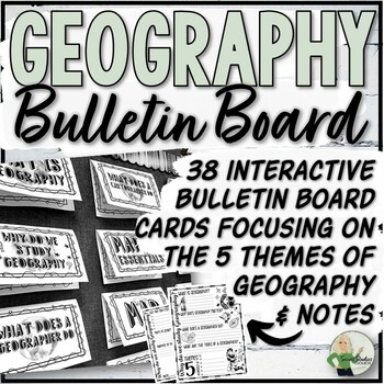
5 Themes of Geography Interactive Bulletin Board and Note Pages
This interactive bulletin board resource for geography and map skills consists of 38 bulletin board cards and 2 accompanying note pages. The bulletin board covers the five themes of geography, including the definition of geography, its importance, the role of a geographer, and map essentials. Students can use the bulletin board, textbook, and teacher-selected websites as reference materials when completing the note worksheets.Just Added:32 half-page bulletin board cards including vocabulary and
Grades:
5th - 10th, Staff
Also included in: Geography Store Growing Bundle
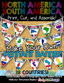
North America South America Classroom Decor Make Your Own Pennant Banner
North America South America Classroom Decor Make Your Own Pennant Banner
Grades K-12 social studies, history, geography, Model UN, global studies, world history
Celebrate our world! Teachers can decorate their classrooms, hallway, gymnasium, media center, or anywhere in their building. You'll get 38 pennants to choose from. Pick pennants that represent your student's heritage, ethnicities, backgrounds, ancestry.
They are colorful and awesome to look at. The countries pennant will bring enthu
Grades:
PreK - 12th, Higher Education, Adult Education, Staff
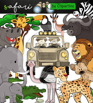
Cute Safari animals Clip Art /African Animals /Commercial use
Safari clipart bundle inclides 22 png files transparent background+jpgand safari clip art 22 png+jpg black-white filessize 1 files about 6 inch 300 dpiFor personal and commercial use!!!African Animals & Savanna clipart (Animal jungle clip art)BinocularjeepJeep with boysBoyscrocodileantelopehippoelephantbaby elephantbuffaloa lionleopardhyenarhinoceroshippostonebeaktreegrassostrich!!!! See more animals clipartOcean animals clipartSafari clipartBugs clipartBirds ClipartDinosaur ClipartArctic An
Grades:
PreK - 12th, Higher Education, Adult Education, Staff
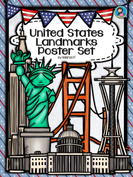
United States Landmarks Facts & Poster Set
If you are looking to improve your students skills in Geography here is the resource you need. I had so much fun researching these Landmarks and sparkle my skills also with the new facts on the most famous landmarks of the United States. Lots of information, but cool things you can use in class. Here is a set of Posters with their Fact Sheet. You can print it on card stock with double sided with the facts or separated to create your own activities for your students. The will have fun with ge
Grades:
PreK - 12th, Higher Education, Adult Education, Staff
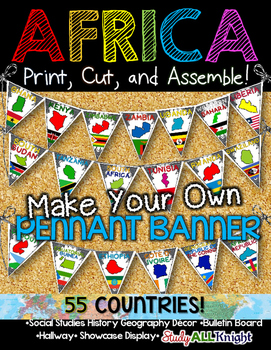
Africa Classroom Decor Make Your Own Pennant Banner
African Countries Classroom Decor Make Your Own Pennant Banner
Grades K-12 social studies, history, geography, Model UN, global studies, world history
Includes:
Ready for you to easily line up by using the directions on how to assemble. The preview shows more!
Includes:
★55 pennant printables – each flag represents a country: the name of the country, the country outline, and their flag.
55 COUNTRIES/ TERRITORIES:
Algeria
Angola
Benin
Botswana
Burkina Faso
Burundi
Cameroon
Cape Verde
Central A
Grades:
K - 12th, Higher Education, Adult Education, Staff
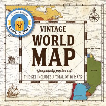
World map and continents: Vintage style geography poster set (10 maps)
World map and continents: vintage style geography poster setThis world and continents set includes a total of 10 maps:• World• Africa• South America• Central America• North America• Europe (2)• Middle East• Asia• OceaniaMaps capture current geographical and political boundaries (as of May 2019) with vintage-style graphics and script. The world map clearly labels continents and oceans. Continent maps label all countries, oceans and include a color-coded country key.These maps are a great addition
Subjects:
Grades:
PreK - 12th, Higher Education, Adult Education, Staff
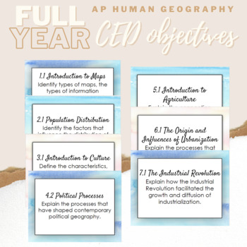
APHG - Learning Objectives - CED Aligned
Display your learning objectives on the wall or on the board with these learning objective cards. Laminate and hang them or use notecard rings to make them easy to flip through for your own reference. There is so much you can do with these! Directly from the APHG CED!
Subjects:
Grades:
9th - 12th, Staff
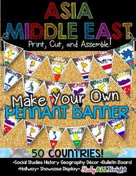
Asia Middle East Countries Classroom Decor Make Your Own Pennant Banner
Asia Middle East Countries Classroom Decor Make Your Own Pennant Banner
Grades K-12 social studies, history, geography, Model UN, global studies, world history
Includes:
Ready for you to easily line up by using the directions on how to assemble. The preview shows more!
Includes:
★50 pennant printables – each flag represents a country: the name of the country, the country outline, and their flag.
50 COUNTRIES/ TERRITORIES:
Afghanistan
Armenia
Azerbaijan
Bahrain
Bangladesh
Bhutan
Brunei
Cambodi
Grades:
K - 12th, Higher Education, Adult Education, Staff
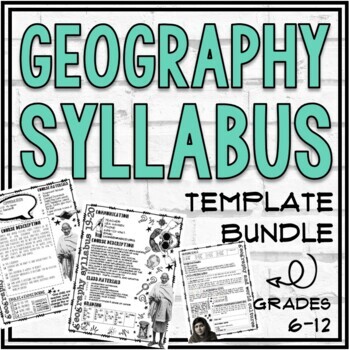
Geography, World Cultures, World Studies, and Generic Syllabus Templates
This product includes Geography, World Cultures, World Studies, and "Generic" Syllabus templates. This resource includes many text-editable template pages and completed syllabi (to use as examples). These visually appealing templates include space to customize the following: Contact information, Classroom Rules/Expectations, Class Materials, Grading, Important Information, and more!This resource is appropriate for a high school or middle school Geography, World Cultures or Social Studies course
Grades:
6th - 12th, Staff
Also included in: Geography Store Growing Bundle
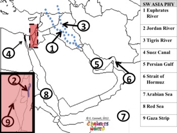
Georgia Social Studies 7th Grade Standard Maps
CHECK OUT THIS SUPER MONEY SAVER COMBO PACKhttp://www.teacherspayteachers.com/Product/Combo-Pack-Georgia-Social-Studies-6th-and-7th-Grade-Standard-Maps-692718This is a series of maps (answer keys and class presentation question pages) in PowerPoint format. The maps are specific to:Georgia StandardsSixth 7th GradeSocial StudiesPhysical FeaturesPolitical FeaturesAfrica, Southwest Asia (Middle East), Southern and Eastern AsiaThis will help teach the features and quiz whole class about the features
Grades:
5th - 8th, Staff
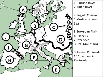
Georgia Social Studies 6th Grade Standard Maps
CHECK OUT THIS SUPER MONEY SAVER COMBO PACKhttp://www.teacherspayteachers.com/Product/Combo-Pack-Georgia-Social-Studies-6th-and-7th-Grade-Standard-Maps-692718This is a series of maps (answer keys and class presentation question pages) in PowerPoint format. The maps are specific to:Georgia StandardsSixth 6th GradeSocial StudiesPhysical FeaturesPolitical FeaturesEurope, Latin America, Canada, and AustraliaThis will help teach the features and quiz whole class about the features. This is GOOD stu
Grades:
5th - 8th, Staff
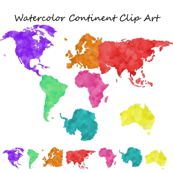
Watercolor Continent Geography Clip Art for Commercial Use
Set of 7 watercolor themed clip art png images with transparent backgrounds.The images included are:North AmericaSouth AmericaEuropeAsiaAfricaAntarcticaAustralia These are also great to print out and use for geography centers or bulletin boards.Note: This is a larger file, it may take longer to download based on your internet connection and download speed. Please be patient.These images are for personal or commercial use. If you are using these to create educational materials for TpT credit is n
Grades:
Staff
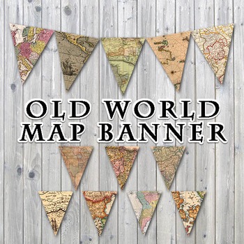
Old World Maps Banner - Printable - Includes 3 Different Sizes
Old World Maps Banner
This listing is for a PRINTABLE PDF file for the "Old World Maps" Banner, as shown.
You will receive 1 - 19 page PDF file that includes the banner in 3 different sizes. You will receive 12 pages with 1 pennant each, measuring approximately 7" x 9", 6 pages with 2 pennants each, measuring approximately 5.45" x 7" and 1 page with 24 pennants, measuring approximately 1.55" x 2". Pennants are scans from old, vintage maps.
Print them off on your own printer, cardstock paper i
Grades:
PreK - 12th, Higher Education, Adult Education, Staff
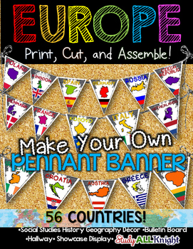
Europe Classroom Decor Make Your Own Pennant Banner
Europe Countries Classroom Decor Make Your Own Pennant Banner
Grades K-12 social studies, history, geography, Model UN, global studies, world history
Includes:
Ready for you to easily line up by using the directions on how to assemble. The preview shows more!
Includes:
★56 pennant printables – each flag represents a country: the name of the country, the country outline, and their flag.
56 COUNTRIES/ TERRITORIES:
Albania
Andorra
Armenia
Austria
Azerbaijan
Belarus
Belgium
Bosnia and Herzegovina
Grades:
K - 12th, Higher Education, Adult Education, Staff
Spain A Research Project
26.7.2020As digital activities does not support zip file I have transferred the poster and answer with the preview. I then can list the resource as individual PDF in order to convert it to digital activities.Spain - A research project is a 13 pages study on Spain. Use it as a class test or research project.Download Preview File - Please view Spain preview file prior to purchasing as the preview is all the resources in this pack. Please ensure that the resource is appropriate for your grade level
Grades:
6th - 8th, Adult Education, Staff
COLOR THE STATES
COLOR THE STATES
These fun activities will help your students become more familiar with the U.S. state's names, capitals, shapes and locations.
I created this packet a number of years ago because many of my students couldn't even recognize the shape of our state, let alone the capital city! It's amazing how diligently they work on the different activities. They color the states according to the directions on the sheets that are included in this packet. For example, all states that begin with t
Grades:
3rd - 8th, Staff
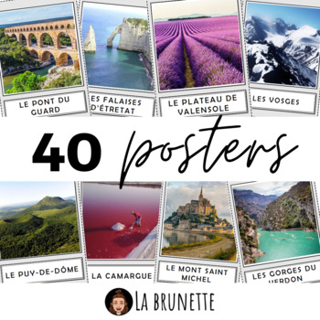
40 posters de décoration sur la France - 40 posters for display about France
40 incredible French sites to display in your classroom !Bring some cultural and colourful elements to your French classroom or MFL corridor with these 40 beautiful pictures of France. This resource includes :This resource includes 40 pictures (PDF format) of the best and most incredible cities, regions and landscapes to visit in France. Each PDF page has a picture in a frame and its name in a separate frame, below. Check the VIDEO PREVIEW to view ALL pictures ! These French touristic sites are
Subjects:
Grades:
PreK - 12th, Staff
Also included in: POSTERS MEGA BUNDLE - 280 PRINTABLE PAGES - France and Francophonie
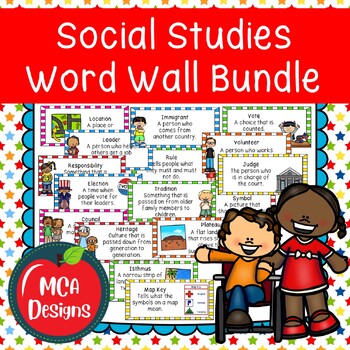
Social Studies Word Wall Bundle Community Government Economics Geography
This set of K-2 Social Studies Word Wall Bundles focuses on community, government, economics, conservation, and geography. This set includes 305 key terms with corresponding definitions and pictures. This product is also included in my Social Studies Units 1 to 7 Community, Government, Geography, and Economics Bundle!The following posters are included with this set:CommunityCitizenResponsibilityVolunteerConsequenceResponsibleSchoolClassroomRespectfulTruthfulnessFairnessCommunity HelperRecreation
Grades:
1st - 5th, Staff
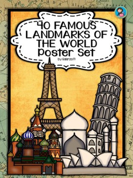
40 Famous Landmarks of the World Poster Set
If you are looking to improve your students skills in Geography here is the resource you need. I had so much fun researching these Landmarks and sparkle my skills also with the new facts on the most famous landmarks of the World. Lots of information, but cool things you can use in class. Here is a set of Posters each with a Fact Sheet. You can print it on card stock with double sided with the facts or separated to create your own activities for your students. The will have fun with geography
Grades:
PreK - 12th, Higher Education, Adult Education, Staff
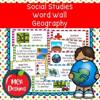
Social Studies Geography Word Wall
This set of Social Studies Geography Word Wall Posters focus on landforms, bodies of water, and using a map. This set includes 69 geography key terms with corresponding definitions and pictures. This product is also included in my Social Studies Units 1 to 7 Community, Government, Geography, and Economics Bundle!The following posters are included with this set:GeographyGeographerMapGlobeCompassCardinal DirectionsLocationRelative LocationAbsolute LocationMap GridSymbolMap KeyDirectionsRouteLandfo
Grades:
1st - 5th, Staff
Also included in: Social Studies Word Wall Bundle Community Government Economics Geography
Showing 1-24 of 197 results


