17 results
Earth sciences Common Core 5.G.A.1 resources
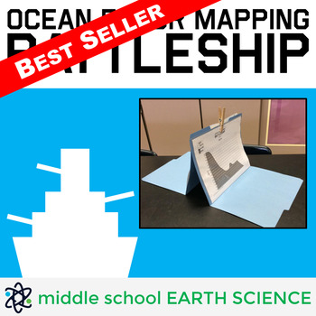
Ocean Floor Mapping Battleship Game
Teacher Review: "My students are obsessed with this activity! They even ask to play during indoor recess!" - Turner's Teaching Troop (January 22, 2020)Ocean Floor Mapping Battleship includes 36 unique maps of the ocean floor, a recording sheet, a detailed lesson plan with suggested pre-game activities, a blank map students can use to draw their own ocean floor, a diagram showing the layers of the ocean, and easy to follow game instructions. Field tested with sixth-graders, this game challenges s
Subjects:
Grades:
5th - 9th
Types:
CCSS:
Also included in: Earth Science Games Bundle
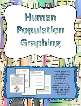
Human Population Graphing Activity
Students graph the human population over time. Included is a short reading about reasons the human population has increased (written for students below 6th grade reading level to comprehend) as well as analysis or discussion questions for after the graph is created.This activity is meant to help students understand that the human population is rapidly growing that that this has an effect on our resources, as well as practice in graphing and graph interpretation and analysis. This addresses the f
Subjects:
Grades:
5th - 8th
Types:
CCSS:
World Weather and Climate Stations Analysis and Graphing for Science and Math
Set up these 6 stations to encourage students to develop their graph-reading skills and help students recognize differences between weather and climate. Simple to use in math or science lessons. Just print, cut, and tape! For today's weather, please visit Accuweather.In this PacketPg 2 Preview Washington DC Fahrenheit (together as a class, one per student)Pg 3-4 Student Handout (print double sided, one per student)Pg 5 Buenos Aires/Cairo Fahrenheit (cut in two and tape one per station)Pg 6
Subjects:
Grades:
3rd - 6th
Types:
NGSS:
3-ESS2-1
, 3-ESS2-2
Also included in: World-focused Science and Math Activities for Upper Elementary
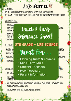
Ohio 5th Science - Reference Sheets: Ecosystems, Space, Sound, Light, Motion
QUICK, EASY SIMPLE! This reference sheet is for any teacher - new or experience - who needs a reference sheet to help guide lesson planning and data driven decision making! Ohio 5th Grade Science :: This includes a reference guide for:: -ECOSYSTEMS-FORCE & MOTION-SOUND-LIGHT -SPACEEach sheet includes: -Standards -Key Vocab-Common Student Misconceptions-Driving QuestionsPerfect for planning, long term subs, new teachers, and reminders for experienced teachers who just need a refresher before
Subjects:
Grades:
4th - 12th
NGSS:
4-PS4-2
, 5-PS1-3
, 5-ESS1-1
, 5-LS2-1
, 5-PS3-1
...
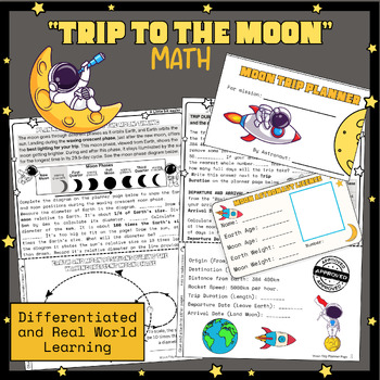
Moon Math, Project based learning, Science, Moon phases, Earth, sun moon system
This pack contains resources needed to undertake a differentiated “Trip to the Moon” Math project with grade 4, 5 and 6 students. Students use math skills to answer questions and complete their astronaut licenses and moon trip planners. It serves as more than a thematic activity and requires students to use math skills to learn about the solar system. Students work individually or in groups on differentiated (3 different versions included) math planning black line masters. The tasks are as follo
Subjects:
Grades:
4th - 6th
Types:
NGSS:
5-ESS1-2
, MS-ESS1-1
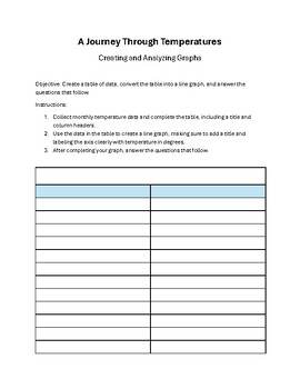
A Journey Through Temperatures: Creating and Analyzing Graphs
Dive into an engaging, educational journey with "A Journey Through Temperatures," a comprehensive worksheet designed to enhance students' skills in data collection, graph creation, and critical analysis. Perfect for 5th-grade learners, this resource offers a hands-on approach to understanding temperature trends and their broader implications.Key Features:Data Collection and Graph Construction: Students start by gathering monthly temperature data, filling in a provided table, and then using this
Subjects:
Grades:
5th - 7th
Types:
NGSS:
5-ESS2-1
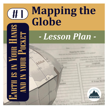
Mapping the Globe: Lesson Plan
This file contains a PDF which includes an inspirational classroom poster, detailed lesson plan with pictures, student worksheet, teacher answer key, and answer template for Mapping the Globe.*While you can use this lesson with other classroom globes or even flat maps, you may be interested in the Student Template: Piper's Folding Globe so students can add to this globe with other Mapping the... lessons throughout the semester while keeping it flat and safe in their binders between lessons.*The
Subjects:
Grades:
5th - 12th
NGSS:
HS-ESS2-1
, 5-ESS2-1
Also included in: Mapping the Globe: Bundle
Volcanoes! Modeling all four types. A STEM on a Shoestring Lab
In this exciting and engaging activity students will blend:· Volcanology· Coordinate graphing· Chemistry· Map readingYou can also incorporate online research if you wish to make this a complete STEM activity.Students will learn about the four types of volcanoes and see where they are located in one of our national parks. They will use coordinate graphing skills to locate each volcano. on their map. Each of the four types of volcano can be modeled using the materials and procedure described.These
Subjects:
Grades:
4th - 6th
Biomes of the World: The Complete Collection
A complete years worth of science and geography with sprinklings of math and language arts! Work with your learners as you navigate through 9 biomes. This curriculum package helps to enable educators to nurture a sense of wonder and encourage their students to study plants, animals, and navigate maps as they choose their way through the various ecosystems. The program culminates in the learner creating a world of their own complete with ecosystems and more!
Subjects:
Grades:
3rd - 5th
Types:
NGSS:
3-ESS3-1
, 3-ESS2-1
, 5-LS2-1
, 3-ESS2-2
, 4-ESS2-2
...
Patterns in Daylight Hours - Does DST Cause the Amount of Daylight to Change?
As the Earth rotates, it creates a daily pattern of shadows that students can observe and measure through hands-on activities. As the Earth revolves, it creates a seasonal pattern in the length of shadows that students can track over time. But Earth’s revolution also creates a pattern of changing daylight hours. Students may know from personal experience that the amount of daylight hours also changes. If you live in a place that observes Daylight Saving Time, students may falsely think that by c
Subjects:
Grades:
5th - 8th
Types:
NGSS:
5-ESS1-2
, MS-ESS1-1
Connecting Constellations - Analyzing Data to Determine Constellation Visibility
What is a constellation? How are constellations related to stars? Are constellations the same everywhere? In this lesson students explore constellations, first by reading short descriptions about 5 constellations then plotting points on a coordinate plane to determine which are visible from the Northern hemisphere and which are visible from the Southern hemisphere. Students will learn use the Science and Engineering Practice Analyzing and Interpreting Data to build background knowledge for succe
Subjects:
Grades:
4th - 6th
Types:
NGSS:
5-ESS1-2
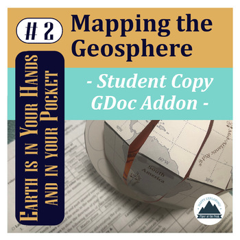
Mapping the Geosphere: Student Copy
This file contains an editable Google Doc for students to fill in. It will guide them through their their second step in labeling their foldable globe- with the layers of the Earth and plate boundary types that create landforms around the world.For more detailed instructions on how to complete this step, check out Mapping the Geosphere: Lesson Plan (detailed teacher directions, teacher template, answer key, and inspirational classroom poster) or the Mapping the Geosphere: Bundle (lesson plan an
Subjects:
Grades:
5th - 12th
Types:
NGSS:
HS-ESS2-3
, HS-ESS2-1
, MS-ESS2-2
, HS-ESS1-5
, 5-ESS2-1
Also included in: Mapping the Geosphere: Bundle
Mapping the Globe: Student Copy
This file contains an editable Google Doc for students to fill in. It will guide them through their their first step in labeling their foldable globe- with latitude and longitude that form the basis of our global coordinate system and continents.*While you can use this lesson with other classroom globes or even flat maps, you may be interested in the Student Template: Piper's Folding Globe so students can add to this globe with other Mapping the... lessons throughout the semester while keeping
Subjects:
Grades:
5th - 12th
Types:
NGSS:
HS-ESS2-1
, 5-ESS2-1
Also included in: Mapping the Globe: Bundle
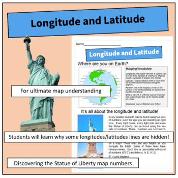
Longitude and Latitude
This resource explains the numbering of latitude and longitude lines circling the Earth. It includes mapping vocabulary and clear diagrams. Students will be surprised to learn that there are numerous invisible lines that allow map readers to accurately locate any point on the globe. The lesson incorporates the famous lines such as the Equator and Prime Meridian. Students are asks to draw an island at a specific location using longitude/latitude and complete the remaining geography of the map.
Subjects:
Grades:
4th - 6th
Types:
Plant Mazes - Science Fair Logbook
Looking to do a science experiment, but don't want your whole class to have to do the same thing, or don't have the time to make a logbook? Look no further.Introducing the Plant Maze logbook, a graphic organizer that includes all aspects needed for a fantastic science fair project. This logbook includes identifying variables and materials, observations written and drawn, a graph to measure growth, conclusion and much more!This logbook is created for a Plant Maze experiment. Students and teachers
Subjects:
Grades:
3rd - 6th
Types:
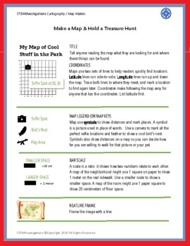
Create Map/Use New Skills to Build A Park, Cartography STEAM Start
Students learn skills to make and read a map using coordinate planes, simulated latitude and longitude, legends, keys, and symbols.Includes:Digital Download PDF FileElementary Map lessonBuild and Recognize symbols, keys, etc.STEAMvestigations: test a student made model
Subjects:
Grades:
3rd - 5th
Types:
NGSS:
3-ESS2-1
, 5-PS3-1
, 4-ESS2-2
Mapping Geohazards: Student Copy
This file contains an editable Google Doc for students to fill in. It will guide them through their their third step in labeling their foldable globe- with locations of volcanoes and earthquakes around the world. It will also connect them to real-time databases to compare how their mapped content compares and analyze patterns.For more detailed instructions on how to complete this step, check out Mapping Geohazards: Lesson Plan (detailed teacher directions, teacher template, answer key, and ins
Subjects:
Grades:
5th - 12th
Types:
NGSS:
HS-ESS2-1
, HS-ESS3-1
Also included in: Mapping Basics Bundle
Showing 1-17 of 17 results

