23,554 results
11th grade geography resources under $5
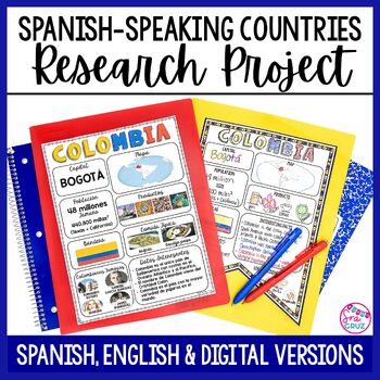
Spanish Speaking Countries Project Research a Country with Google Slides Digital
This Spanish-Speaking country project is an organized and efficient way for students to research Spanish-speaking countries. The templates are in both English and Spanish and can be completed digitally or handwritten. Includes digital templates for PowerPoint and Google Slides.*can easily be adapted for other languages, geography, or social studies classesThis project to create an infographic for a country includes:-Templates in 3 different designs-English templates-Spanish templates-Completed
Subjects:
Grades:
6th - 12th
Types:
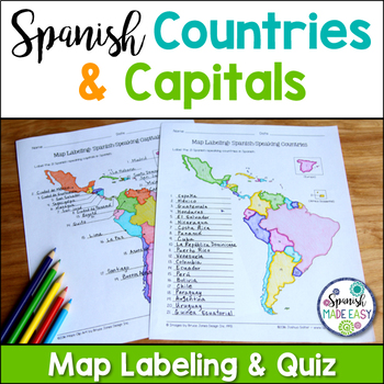
Spanish-Speaking Countries and Capitals Maps and Quiz
This is a map labeling activity and matching quiz over the 21 Spanish-speaking countries and capitals. Students will label and identify the 21 Spanish-speaking countries and capitals in Spanish. This is a great activity when reviewing Spanish-speaking countries and capitals or Spanish geography. Makes a great coloring page. Answer keys are included.
Countries included:
España, México, Costa Rica, El Salvador, Guatemala, Honduras, Nicaragua, Panamá, Cuba, La República Dominicana, Puerto Rico, Ar
Subjects:
Grades:
6th - 12th
Also included in: Spanish Countries and Capitals Geography Bundle
My Ecological Footprint: Fun Online Activity and Worksheet about Climate Change
Take your class to the computer lab for a fun and engaging activity! Students will use an interactive website to find out how their lifestyle determines their ecological footprint and impacts our planet. This activity is the first step in a fun lesson that spans two classes and gets your students learning about the environmental impact of the choices we make every day. This lesson fits perfectly into a unit or course about climate change, environmentalism, geography or world issues. There is lit
Subjects:
Grades:
9th - 12th
Types:
Also included in: Climate Change and Environmental Sustainability Bundle for High School
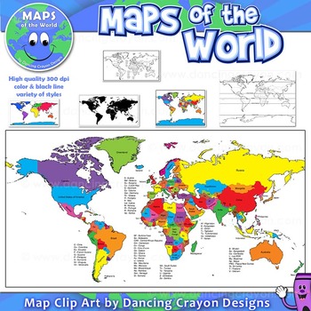
Maps of the World: Clip Art World Maps
Maps of the World: Clip Art World Maps
High quality color and black and white maps of the world.
This clipart map set contains the following commercial use graphics:
- Color maps of the world
- Black and white line art maps of the world
- Maps of the world with lines of latitude and without lines of latitude
- Maps of the world with larger countries labelled (color and black and white)
- Silhouette maps of the world
- A map of the world showing seven continents in color and black and white:
Grades:
3rd - 12th, Higher Education, Adult Education, Staff
Also included in: Maps of the World Clip Art - MEGA-BUNDLE
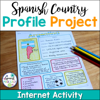
Spanish Country Profile Project
This is a country profile project over the 21 Spanish-speaking countries. Students will research important geographical and cultural facts about each country. This activity includes a blank country profile template, a template for each country, a list of Spanish-speaking countries, and a grading rubric in both English and Spanish. Research topics include: Countries flag, map, capital, language(s), population, area, currency, climate, interesting facts, tourism and attractions, cuisine, sports, a
Subjects:
Grades:
2nd - 12th
Types:
Also included in: Spanish Countries and Capitals Geography Bundle
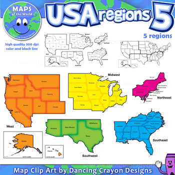
Regions of the USA: Five Regions - Map Clip Art
Regions of the USA: Five Regions - Map Clip Art
.............................................................................................
Please check the regions in this set before purchase. We offer a choice of THREE different US Region Map Sets:
USA divided into FOUR regions / NINE divisions (as set out by the United States Census Bureau)
USA divided into FOUR regions / TEN divisions (as taught in some states)
Please read on for more information about THIS region set:
............
Grades:
3rd - 12th, Staff
Also included in: Maps of the World Clip Art - MEGA-BUNDLE
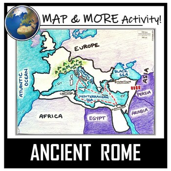
Ancient Rome Map Activity- Roman Empire (Label and Color!)
This Ancient Rome Map Coloring & Labeling Activity is a great resource to enhance your unit! Each student will make their own, personalized map of the Roman Empire, and learn about the geography and landmarks of the region. They will label and color their blank map, and answer follow-up questions related to the geography of Ancient Rome. A fun 'Make a Travel Brochure' project has also been added. It is a great way to connect this map activity to your lesson on Ancient Rome! A link to Goo
Grades:
4th - 11th
Types:
CCSS:
Also included in: Ancient Civilizations / World Maps BUNDLE- Color & Label Activities!
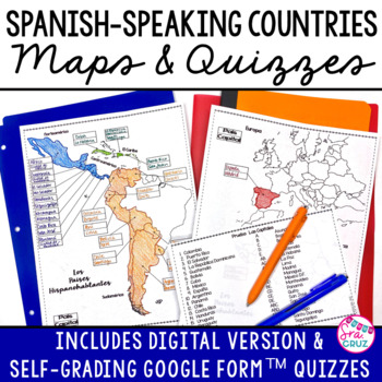
Spanish Speaking Countries and Capitals Maps and Quizzes Worksheet + DIGITAL
Spanish-Speaking Countries Maps and Quizzes - Included are blank maps of the Spanish-speaking countries for students to fill in, completed maps, a map quiz, and a matching capitals quiz. NEW: Now includes Google Slides™ version of the map for students to fill in digitally and self-checking Google Forms™ quizzes for the map and capitals quizzes.*Please see the thumbnails & preview for more details*Includes:✅ Blank Maps-One page map without Equatorial Guinea-Two page map with Equatorial Guinea
Subjects:
Grades:
6th - 12th
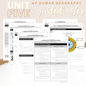
Unit 5: Student Guided Notes - AP Human Geography
Notes pages for CED topics 5.1-5.10 for Unit Five. *NOTE: THIS IS MISSING TOPICS 5.11 and 5.12*Use the guided notes to scaffold your Human Geography lectures or use the notes with my accompanying lecture slideshows! You can find slideshow lectures that correlate directly with EACH CED Topic for AP Human Geography Unit 5 here.Students can use as a study guide, you can assign for homework, or use with a self-guided lecture! You can assign this to be completed digitally for distance learning or pri
Grades:
9th - 12th
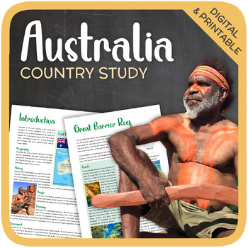
Australia (country study)
Let’s get to know Australia! This worksheet includes 21 pages with a great variety of activities and exercises about Australia. The materials have informative exercises about the things that Australia is famous for, such as the Great Barrier Reef, Aboriginals, Tasmania, the Sydney Opera House, and many other things! Word searches, puzzles and other kinds of activities are included to make it a fun and interesting class. GOOGLE SLIDES WITH PREMADE TEXTBOXES INCLUDED! Overview:Page 1-2: Introduct
Grades:
6th - 11th
Types:
Also included in: Top 10 Best-selling Units (Country Studies Bundle)
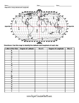
Latitude and Longitude Worksheet & Answer Key
This worksheet is an awesome way to teach Latitude and Longitude. The way that it is structured reinforces that Latitude measures North and South of the Equator, and that Longitude measures East and West of the Prime Meridian. This worksheet features a World Map with an Answer Key.
Subjects:
Grades:
3rd - 12th, Higher Education, Adult Education
Types:
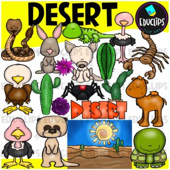
Desert Clip Art Set {Educlips Clipart}
A collection of desert and desert animal images. The graphics in this pack are: black widow spider, cactus plants, camel, desert background, desert rose, eagle, tortoise, fennec fox, gekko, jackrabbit, meerkat, ostrich, rattlesnake, scorpion, vulture, word art.38 images (19 in color and the same 19 in B&W)Images saved at 300dpi in PNG files.For personal and commercial use..Download preview for TOU.©Educlips LLC 2014Follow Educlips on FacebookFollow Educlips on InstagramKeywords: desert, biom
Grades:
PreK - 12th, Staff
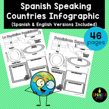
Spanish Speaking Countries Infographic (Los paises hispanohablantes)
Spanish Speaking Countries Infographic (Inforgrafica de los paises hispanohablantes) This products would be great for Spanish class, Latin American History or Spanish Heritage class, or a Spanish or Dual Immersion class. You could use an infographic about each country all throughout the school year or have students do a research project and have 1-2 students do each country and present to the class. This could also be an independent research center for grades 2-6 in the Spanish Immersion setting
Subjects:
Grades:
2nd - 12th
Types:
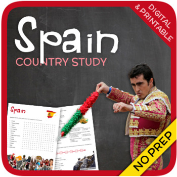
Spain (country study)
Let’s get to know Spain! This worksheet includes 23 pages with a great variety of activities and exercises about Spain. The materials have informative exercises about the things that Spain is famous for, such as Bullfighting, Catalonia, Sagrada Familia, Picasso, Tapas and many other things! Crosswords, word searches, puzzles and other kinds of activities are included to make it a fun and interesting class. GOOGLE SLIDES WITH PREMADE TEXTBOXES INCLUDED! Overview: Page 1-2: IntroductionPage 3-4:
Grades:
5th - 12th
Types:
Also included in: Top 10 Best-selling Units (Country Studies Bundle)
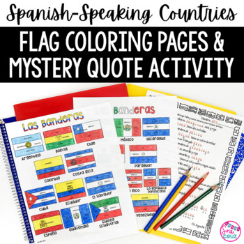
Spanish Speaking Countries Flags Worksheets Spanish Colors Coloring Pages
These coloring pages practice Spanish colors using flags of Spanish-speaking countries. Line versions of each flag have the color in Spanish for each section of the flag (rojo, blanco, azul, etc.) It also includes a mystery phrase activity in basic Spanish using clues about each flag. Ex. La bandera de Colombia es ___, azul, y roja. The answers help solve the secret phrase which is a quote about travel. The answer key for the mystery phrase page is included.These can be copied front and bac
Subjects:
Grades:
4th - 12th
Types:
13 Colonies: Comparing Regions - New England, Middle, & Southern Colonies
13 Colonies: Comparing the Regions – New England, Middle & Southern ColoniesThis lesson teaches how the three regions of the 13 Colonies differed from one another: New England, the Middle Colonies, and the Southern Colonies. Students will learn how the climate and geography of the three colonial regions impacted the economic as well as the social lives of colonists in the three regions of the 13 Colonies. Students will learn how the New England colonists had to look to different types of rev
Subjects:
Grades:
5th - 11th
Also included in: Early US History Bundle: 1492 - Civil War
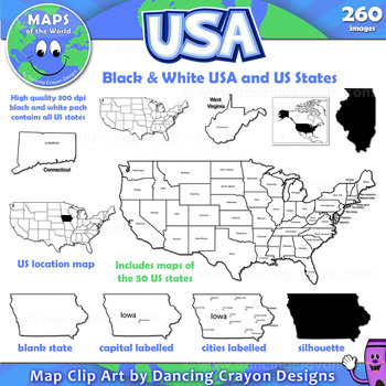
Maps of the USA and US States: Black and White Bundle
A practical set containing our black and white USA maps and US States maps.
260 images of the USA and individual US states in black and white line art. Perfect for creating worksheets and printables.
If you are looking for both color and black and white please see our USA maps bundle:
Click here for USA Map Bundle.
This clipart map set contains the following commercial use graphics:
- Black and white line art maps of all 50 US states in the following styles:
- Blank
- capi
Grades:
3rd - 12th, Staff
Russia (country study)
Let’s get to know Russia! This worksheet includes 22 pages with a great variety of activities and exercises about Russia. The materials have informative exercises about the things that Russia is famous for, such as Vladimir Putin, the Soviet Union, tsars, Lenin, Siberia, the Cold War and many other things! Crosswords, word searches, puzzles and other kinds of activities are included to make it a fun and interesting class. GOOGLE SLIDES WITH PREMADE TEXTBOXES INCLUDED! Overview: Page 1-2: Introd
Subjects:
Grades:
6th - 12th
Types:
Also included in: Top 10 Best-selling Units (Country Studies Bundle)
Types of Government Digital Scavenger Hunt
Take your students on an exciting global journey to discover diverse forms of government with our "Government Types Digital Scavenger Hunt." This interactive and educational resource is designed to engage learners of all ages, making it easy to adapt to various teaching styles and preferences.What's Included:Interactive World Map: A visually captivating map featuring clickable links and QR codes that transport students to countries around the world with different types of government.Government T
Subjects:
Grades:
6th - 12th
Types:
Also included in: Middle School World Cultures & Geography Course
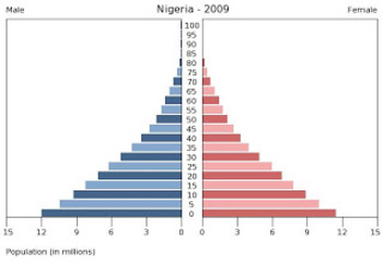
Population Pyramids Lesson and Activity
UPDATED 2023! This product now has an updated version with population data from 2020-2022 for the practice countries. This product will teach students the basics of how to read, understand and analyze population pyramids. The product has a student note piece along with an activity that can be used as an individual assignment or as a cooperative group activity. After students learn how to read a population pyramid they will construct their own using data provided and then analyze the pyramid(s)
Grades:
8th - 12th
Types:
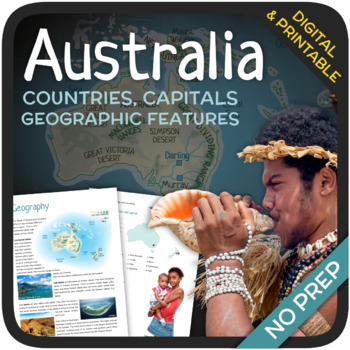
Geography of Australia & Oceania
Let’s learn about the geography of Australia and Oceania! This unit includes a wide variety of exercises, map quizzes, puzzles, and close reading activities about the countries, capitals, and geography of Australia and Oceania. The answers and answer sheets are included. GOOGLE SLIDES WITH PREMADE TEXTBOXES INCLUDED!Overview:Page 1-2: IntroductionPage 3-4: Regions and CountriesPage 5-8: Map Quizzes (countries & capitals)Page 9-11: GeographyPage 12-13: Map Quizzes (geographic features)Page
Subjects:
Grades:
6th - 11th
Types:
Also included in: Geography of the World (Bundle)
Mexico (country study)
Let’s get to know Mexico! This worksheet includes 20 pages with a great variety of activities and exercises about Mexico. The materials have informative exercises about the things that Mexico is famous for, such as Chichen Itza, Lucha Libre, the Mayans, the Aztecs, food, and many other things! Crosswords, word searches, puzzles and other kinds of activities are included to make it a fun and interesting class. GOOGLE SLIDES WITH PREMADE TEXTBOXES INCLUDED! Overview:Page 1-2: IntroductionPage 3-4
Subjects:
Grades:
6th - 12th
Types:
Also included in: Top 10 Best-selling Units (Country Studies Bundle)
Explore Weathering and Erosion with a Google Maps Virtual Field Trip
All links verified working Feb 2024Click around this Google Maps Street View field trip to explore locations that showcase the process of weathering and erosion! This activity provides you with a link-embedded reading passage / response sheet to distribute to students. The reading gives students information about each of the following processes of weathering: mechanical (wind, moving water, glacial, ocean waves, ice wedging, organic weathering) and chemical (oxidation, carbonation, organic).Ther
Subjects:
Grades:
4th - 12th
Types:
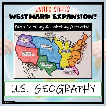
Westward Expansion Map Activity (Label and Color the Map!)
This US Geography Map Activity is a MUST for students who are learning about Westward Expansion! Students will identify, label, and color the various territories that were acquired by the United States to complete the borders that it has today. Directions for labeling and coloring are provided. A completed and colored map is provided for reference, but this map can be completed using a textbook or online resource as well. This is a creative and engaging way of supplementing lessons on geograph
Grades:
3rd - 11th
Types:
Showing 1-24 of 23,554 results


