2,000+ results
Geography classroom decors $5-10
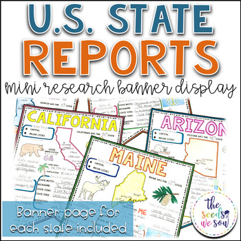
State Report Research and Banner Display Project
If you're looking for an alternative way for your students to research and report on states in the U.S., then look no further. These research banners are not only engaging and educational, they are also visually appealing and provide a great classroom/hallway display.This set includes:● 50 visually appealing state banners● 50 state banners with writing lines (and state flag)● 50 blank state banners for student creativity● Teacher lesson plan page (includes research web sites)● Student recording
Grades:
5th - 8th
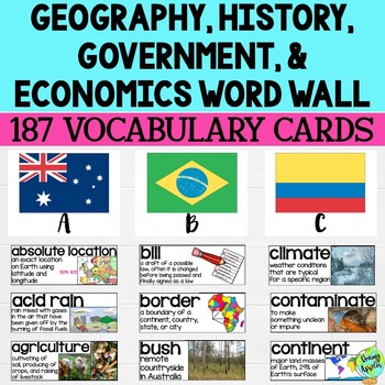
Social Studies Word Wall Vocabulary Cards, Bulletin Board Idea
This product is a word wall to help teach important social studies vocabulary words to students. It can also be used as a social studies bulletin board!The specific regions included are Europe, Australia, Latin America and the Caribbean, and Canada. However, the domains include geography, government, economy, and history, so this resource can be used in most social studies classrooms. Also, many terms are not specific to these regions and can be applied broadly.Each word card includes the vocabu
Grades:
3rd - 11th
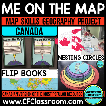
Me on the Map, CANADA - A Social Studies & Language Arts Project
This Canadian Me on the Map resource is based on Joan Sweeney's book, Me on the Map. While this book is based on American Geography, it would be beneficial to read the book with the project, but it is not necessary. Students design a layered step book to represent their place on the map. You may then have them create an art project of themselves on the earth to match the cover of the book. It makes a great bulletin board display and is such a fun way to practice map skills!This is an integrated
Grades:
1st - 5th
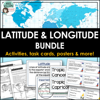
Latitude and Longitude Bundle - Activities, Task Cards, & Posters
Latitude and Longitude - Everything you need to teach and practice latitude and longitude skills! 1. Latitude & Longitude Reference Sheets and Activities - reference sheets, worksheets and activities to teach students how to find a spot on the globe using latitude and longitude. Includes answer keys. 11 pages.2. Latitude & Longitude Task Cards - 4 different sets of task cards (12 cards per set, Canadian set has 14) with varying degrees of difficulty. Includes answer keys. Includes se
Subjects:
Grades:
5th - 9th
Types:
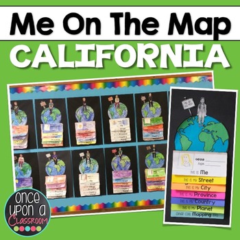
Me on the Map - California
I take requests!!! Need a different state? Different country? Email me at erinneb@yahoo.ca and I would be more than happy to make one for you!
Elevate your Local Community or Global Community units with this interactive mapping flip book! Not only will students gain an understanding of their place in the world but you will have the BEST bulletin board display in the entire school showcasing their amazing learning!
This pack includes:
1. Full page-by-page assembly instructions with pho
Grades:
K - 3rd
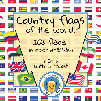
Country flags of the world: 263 Country flags - clip art bundle (1052 clips!)
Country flags of the world: 263 Country flags. HUGE clip art BUNDLE!
This clip art contains 263 flags, in 2 forms (flat and with mast) in color and black & white line art.
Contains all the flags of the countries of the world : 195 Countries.
Look at the complete list of flags by downloading the preview
A total of 1052 clips!
Included:
263 color flag (flat) clip art flag set- PNG format
263 B&W flag (flat) clip art set- PNG format
263 color flag (with mast) clip art set- PNG format
Grades:
PreK - 12th, Higher Education, Adult Education
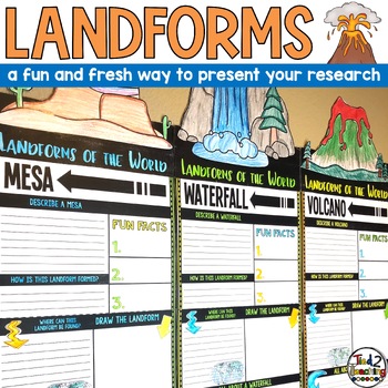
Landforms Research Report Template Project Informational Report Writing Reports
These Landform Informtional Writing Research Report Template Pennant Banners come with over 20 amazing pennants for displaying your landform research project on the amazing landforms from around the world. Perfect for any time of the year, these pennants are a great way to supplement your science instruction as well as help your students organize their research. Save time by integrating your science and ELA instruction! In addition to being excellent informational organizers for your students,
Subjects:
Grades:
3rd - 5th
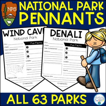
National Park Research Project Activity | Pennants | National Park Week
Do you teach using the National Parks? In this resource, you will find all 63 National Park pennants. These pennants are perfect for a mini-research project or for your students to celebrate National Park Week in April. There are two versions of each pennant- one with a map and one without a map. There is also a "National Park Passport" cover if you would like to make the pennants into a booklet.Includes space for the following information:City & StateYear EstablishedHistoryPlantsAnimalsFamo
Subjects:
Grades:
2nd - 5th
CCSS:
Also included in: National Parks Bundle
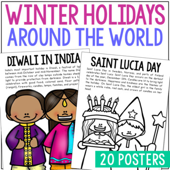
WINTER HOLIDAYS AROUND THE WORLD Posters | Christmas Culture Study Activity
This set of Christmas around the World posters is super versatile! You'll receive the pages in black/white AND full color. Shrink them down for interactive notebook inserts, mini books, bulletin board decor, hall displays, or as a quick coloring page to accompany your read-aloud. Students love these note pages because they provide just enough new vocabulary and ideas to engage but aren’t overwhelming.CLICK HERE to save 25% on this resource in the Christmas Posters Bundle!WINTER HOLIDAY THEMES IN
Grades:
PreK - 5th
Types:
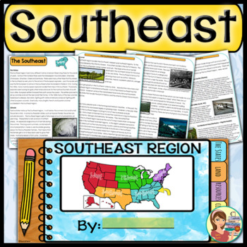
US Regions: Southeast Region (Print and Digital)
This is a comprehensive resource that explores the twelve states in the Southeastern region. A non-fiction informational text packet covers the region’s history, climate, land, economy, natural resources and landmarks. Several other items are included in this resource as well. Please see below for more details. UPDATE: Mississippi's new flag has been added to the poster.★ ★ ★ BUNDLE ALERT! DO NOT MISS THE SAVINGS! ★ ★ ★SAVE 20% OFF individual unit prices when you purchase the Five Regions of
Grades:
4th - 6th
Types:
Also included in: 5 Regions of the United States BUNDLE (Print and Digital)
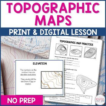
Topographic Maps Complete Lesson | Topographic Map Activity
Your students will be reading topographic maps in a snap with this complete topographic map lesson. Included in this digital and print topographic map lesson are no-prep resources to teach your students to read contour lines, determine contour intervals, and identify elevation. The digital version can easily be shared in Google Classroom.Take a look at the in-depth preview for a closer look at this topographic map resource! Included in this topographic map resource:Topographic Map Presentation
Subjects:
Grades:
4th - 8th
NGSS:
4-ESS2-2
Also included in: Topographic Map Activity and Topographic Map Worksheets Bundle
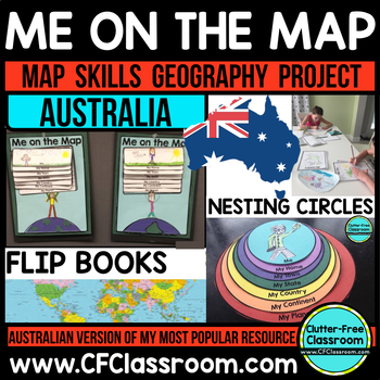
Me on the Map - AUSTRALIA - A Geography & Language Arts Project
This Australian Me on the Map resource is based on Joan Sweeney's book, Me on the Map. While this book is based on American Geography, it would be beneficial to read the book with the project, but it is not necessary. Students design a layered step book to represent their place on the map. You may then have them create an art project of themselves on the earth to match the cover of the book. It makes a great bulletin board display and is such a fun way to practice map skills!This is an integrate
Grades:
1st - 5th
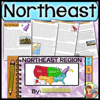
US Regions: Northeast Region (Print and Digital)
This comprehensive resource explores the eleven states in the Northeastern region. A non-fiction informational text packet covers the region’s history, climate, land, economy, natural resources and landmarks. Several other items are included in this resource as well. Please see below for more details.UPDATE: This resource now includes GOOGLE SLIDE versions for the student worksheets, booklet and the PowerPoint presentation.★ ★ ★ BUNDLE ALERT! DO NOT MISS THE SAVINGS! ★ ★ ★SAVE 20% OFF individ
Grades:
4th - 6th
Types:
Also included in: 5 Regions of the United States BUNDLE (Print and Digital)
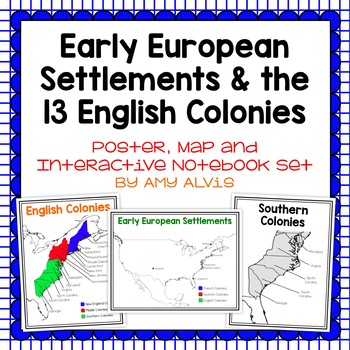
Early European Settlements & 13 English Colonies Poster and INB
This poster, map and interactive notebook INB set covers covers the early American settlements of Santa Fe, St. Augustine, Roanoke Island, Jamestown, Plymouth and Quebec as well as the original 13 colonies.You will get the following:pg. 3: Poster of Early European Settlements (Santa Fe, St. Augustine, Roanoke Island, Jamestown, Plymouth, and Quebec)pg. 4: Map of Early European Settlements where students can map where each settlement was.pg. 5-12: Posters of 13 Coloniespg. 13: Map page for stud
Grades:
5th - 9th
World Travel - Travel Classroom Theme Bulletin Board Kit
This bulletin board kit is a must have for your classroom! Perfectly suited for bulletin boards of all sizes, or even your door, your kiddos and parents will love seeing this happy decor!Why a digital bulletin board?Immediate deliveryNever wears out, just print again!Convenient and easy to useSo much cuter then standard in-store optionsIncluded with this purchase:3 Different Sayings in 3 Different Color Choices (Solid Black, Multicolor, & Black Outline)BannerBoard DecorAt-Home Print: PDF (8.
Grades:
Not Grade Specific
Map Skills & Landforms Unit
Do your students need practice with map skills? Do they need engaging activities to help them learn key vocabulary and directions? If so, this unit is perfect for them!What's Included?Map Skills Practice:Zoo - Using a Map Key to Place Objects on a MapIn the Neighborhood - Answering Questions about the MapPlacing Objects using North, South, East, WestTreasure! - Finding objects that are North, South, East, WestClassroom Map - Answering Questions about a Classroom MapOur Classroom - Make your Own
Grades:
PreK - 2nd
Types:
Landforms: For Young Globetrotters
Get your little globetrotters excited about landforms with this engaging bundle!
Use the posters to introduce landforms to your students, and have them make their own Globetrotter's Guide to Landforms. Don't feel limited by the clipart, blank templates allow you add your own!
What's Included:
Cover
Directions
Landforms Poster
Mountain Poster
Canyon Poster
Volcano Poster
Plain Poster
Valley Poster
Hill Poster
River Poster
Desert Poster
Island Poster
Ocean Poster
Lake Poster
Student Book: A Glo
Grades:
1st - 4th
Types:
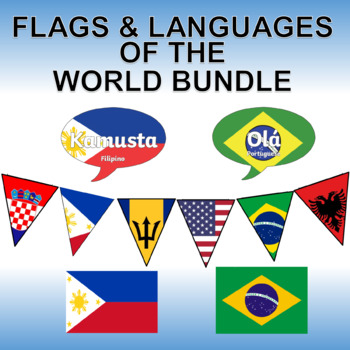
Flags and Languages of the World Bundle - Clipart, Posters and Printable Banner!
Contains five of our best products! Savings of 50%!Languages of the World - Hello in Every Language - Printable PostersThis is a set of 162 color, printable posters that showcase the word "HELLO" in all of the languages of the world. Each has its own unique flag in the background along with the name of the language itself.Flags of the World Banner / Bunting / PennantThis 203 flag collection is an excellent resource for creatively displaying world flags in your classroom.You will receive a zip f
Grades:
Not Grade Specific
Types:
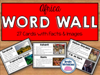
Africa Word Wall
These word wall cards are the perfect way for your students to familiarize themselves with important vocabulary words from the Africa Unit (as outlined by the Georgia Standards of Excellence: SS7G1, SS7G2, SS7G3, SS7G4, SS7CG2 and SS7H1). Please see the preview file for a complete list of the words included. The cards include the vocabulary term, important facts, and images. Just print out the cards, laminate them, and tape them to you wall and you are good to go!
Included in this file:
~Georgi
Grades:
7th
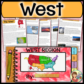
US Regions: West Region (Print and Digital)
This is a comprehensive resource that explores the eleven states in the Western region. A non-fiction informational text packet covers the region’s history, climate, land, economy, natural resources and landmarks. Several other items are included in this resource as well. Please see below for more details. UPDATE: This resource now includes GOOGLE SLIDE versions for the student worksheets, booklet and the PowerPoint presentation.★ ★ ★ BUNDLE ALERT! DO NOT MISS THE SAVINGS! ★ ★ ★SAVE 20% OFF in
Grades:
4th - 6th
Types:
Also included in: 5 Regions of the United States BUNDLE (Print and Digital)
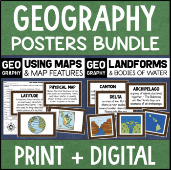
Geography Landforms & Bodies of Water Types of Maps Map Elements Posters
This maps and landforms bundle includes two sets of visual aids for teaching geography along with worksheets and topic assessments.INCLUDES:MAPS AND MAP FEATURESThis resource helps students learn about the different types of maps and common map features. It includes 17 visuals/posters plus a worksheet/assessment.POSTERS - These can be kept together as a single page or cut apart into separate cards for display or a matching activity. The top of each card has the title and definition, and the bott
Grades:
4th - 7th
Types:
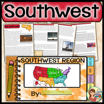
US Regions: Southwest Region (Print and Digital)
This is a comprehensive resource that explores the four states in the Southwestern region. A non-fiction informational text packet covers the region’s history, climate, land, economy, natural resources and landmarks. Several other items are included in this resource as well. Please see below for more details. UPDATE: This resource now includes GOOGLE SLIDE versions for the worksheets, booklet and presentation.★ ★ ★ BUNDLE ALERT! DO NOT MISS THE SAVINGS! ★ ★ ★SAVE 20% OFF individual unit price
Grades:
4th - 6th
Types:
Also included in: 5 Regions of the United States BUNDLE (Print and Digital)
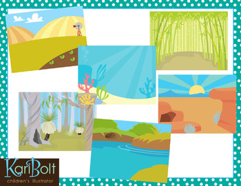
Habitats and Landscapes Clip Art Scenes
25 different habitats in color and black and white. 11x8.5" each (NOTE-preview file is reduced 50% to be able to show all scenes in color and black and white).
WHAT YOU GET IN THIS SET
• Antarctica • Asian Mountains • Australian Bush • Bamboo Forest • Beach
• Farm • Desert • Jungle • Mountains • Ocean • Park • Pine Forest • Pond
• Prairie • Rainforest • River • Rugged Mountains • Sand • African Savannah
• Cypress Swamp • Winter Field • Woods • Woods with a Cave • Zoo
• Tropical Beach
========
Subjects:
Grades:
PreK - 6th
Exploring Maps: Pirate Style! {The Basics}
Looking for supplemental materials?!
Explore maps... PIRATE STYLE!
This 69 page supplemental resource packs in a lot of foundational, BASIC map skills in fun, interactive, developmentally friendly ways! Use a hula hoop, Silly Bands, and rumpled up paper bags to navigate through your mapping unit! :) It's best used as a review of basic elements of maps, and it is intended to be a supplement to your existing unit.
What's Included:
Cover
Introduction: Map Treasures
Teaching About Maps
Pirate
Grades:
1st - 2nd
Types:
Showing 1-24 of 2,000+ results


