30 results
Geography thematic unit plans on sale
Mapping Skills with Google Earth: How to Read a Map Gr. PK-2
This is the chapter slice "How to Read a Map" from the full lesson plan "Mapping Skills with Google Earth"About the FULL RESOURCE:Teach your students the basics of map reading with our engaging resource designed for students in grades prekindergarten to two. Start with the elements found on a map, such as symbols, legends and the compass rose. Then, have your students apply what they’ve learned by mapping their classroom and route to school. Move on to the Great Lakes of North America and the se
Subjects:
Grades:
PreK - 2nd
Mapping Skills with Google Earth: Latitude, Longitude and Time Zones Gr. 3-5
This is the chapter slice "Latitude, Longitude and Time Zones" from the full lesson plan "Mapping Skills with Google Earth"About the FULL RESOURCE:Students will learn in-depth how to read and create maps with our engaging resource designed for students in grades three to five. Students will expand their knowledge of the elements on a map by exploring the lines of latitude, longitude and time zones. Then, students will learn about geographical and cultural features by exploring topographic and ch
Subjects:
Grades:
3rd - 5th
Mapping Skills with Google Earth: Map Elements Gr. 6-8
This is the chapter slice "Map Elements" from the full lesson plan "Mapping Skills with Google Earth"About the FULL RESOURCE:Move on from a basic understanding of map reading to a more complex one with our engaging resource designed for students in grades six to eight. Students will further develop their ability to read and understand maps by looking at weather and population maps. Then, students will engage in mapping their country in detail, including states, provinces, capitals, cultural and
Subjects:
Grades:
6th - 8th
Mapping Skills with Google Earth: Basics of Map Reading Gr. 3-5
**This is the chapter slice "Basics of Map Reading" from the full lesson plan "Mapping Skills with Google Earth"** About the FULL RESOURCE:Students will learn in-depth how to read and create maps with our engaging resource designed for students in grades three to five. Students will expand their knowledge of the elements on a map by exploring the lines of latitude, longitude and time zones. Then, students will learn about geographical and cultural features by exploring topographic and choropleth
Subjects:
Grades:
3rd - 5th
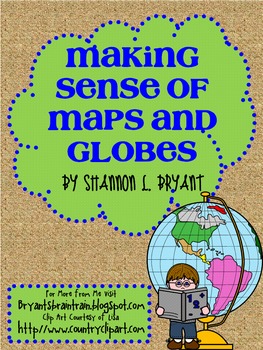
Maps and Globes Geography Unit
This interdisciplinary resource pack was compiled after many years of teaching geography and social studies to my own students. It is always so amazing to watch my students develop an understanding of geographic principles, critical thinking, and cultural awareness during this course of study! Key concepts include geography and cartography, types and functions of maps and globes, map scales, map keys, latitude, longitude, hemispheres, oceans, continents, etc.
This unit may be used as a whole,
Grades:
3rd - 6th
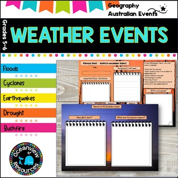
Natural Disasters and Extreme weather events. Unit of work
This extreme weather and natural disasters research unit is perfect for students who are learning how to use informational text and studying weather and natural disasters. It is perfect for a natural disasters and extreme weather research project.Use this resource to explore the following concepts with your students:✔ Where these weather events occur✔ How frequently they occur✔ Why they occur✔ How they are formed and caused✔ How we can prepare, act and survive such events✔ The effects of these w
Subjects:
Grades:
4th - 6th
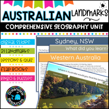
AUSTRALIAN LANDMARKS PACK -A comprehensive Geography Unit
What is a landmark?A landmark is an interesting or an important place.It can be an object, structure or place that is easy to see and recognise.It can be natural or man-madeA prominent identifying feature of a landscape.A fixed marker, such as a concrete block, that indicates a boundary line.An event marking an important stage of development or a turning point in history.A building or site with historical significance, especially one marked for preservation by a municipal or national government.
Grades:
4th - 6th, Staff
Also included in: Australian Geography and Celebration Days Bundle-
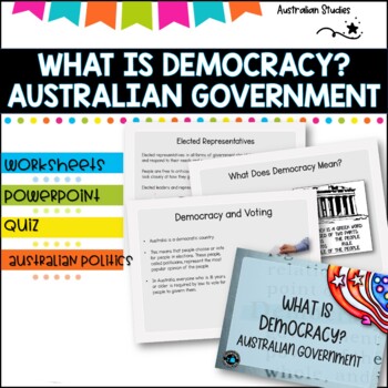
Australian Democracy and levels of government.
What is democracy?AimI can describe the main features of a democracy and discuss the rights and responsibilities of citizens in AustraliaLearning IntentionsTo learn about the different levels of government used to maked decisions and laws in AustraliaWhat is the system of Government in AUSTRALIA?Basic rightsWho rules Australia?What does democracy mean?Democracy and votingYoung people and democracyMain political partiesVotingElected representativesLevels of GovernmentLaw and orderWhat is included
Grades:
4th - 6th, Staff
Mapping Skills with Google Earth: Map Your Classroom Gr. PK-2
This is the chapter slice "Map Your Classroom" from the full lesson plan "Mapping Skills with Google Earth"About the FULL RESOURCE:Teach your students the basics of map reading with our engaging resource designed for students in grades prekindergarten to two. Start with the elements found on a map, such as symbols, legends and the compass rose. Then, have your students apply what they’ve learned by mapping their classroom and route to school. Move on to the Great Lakes of North America and the s
Subjects:
Grades:
PreK - 2nd
Mapping Skills with Google Earth: Map Your Community Gr. PK-2
This is the chapter slice "Map Your Community" from the full lesson plan "Mapping Skills with Google Earth"About the FULL RESOURCE:Teach your students the basics of map reading with our engaging resource designed for students in grades prekindergarten to two. Start with the elements found on a map, such as symbols, legends and the compass rose. Then, have your students apply what they’ve learned by mapping their classroom and route to school. Move on to the Great Lakes of North America and the s
Subjects:
Grades:
PreK - 2nd
Landforms Unit
This interdisciplinary resource pack was compiled after many years of teaching geography and social studies to my own students. It is always so amazing to watch my students develop an understanding of geography, landforms, and literature through this unit of study! Key concepts include types of landforms, erosion, weathering, spelunking, geography, etc.
This unit may be used as a whole, or you may simply glean from it the portions which you feel are most beneficial for your own students. With
Subjects:
Grades:
3rd - 6th
Mapping Skills with Google Earth: Map Your Continent Gr. PK-2
**This is the chapter slice "Map Your Continent" from the full lesson plan "Mapping Skills with Google Earth"** About the FULL RESOURCE:Teach your students the basics of map reading with our engaging resource designed for students in grades prekindergarten to two. Start with the elements found on a map, such as symbols, legends and the compass rose. Then, have your students apply what they’ve learned by mapping their classroom and route to school. Move on to the Great Lakes of North America and
Subjects:
Grades:
PreK - 2nd
Australia: Human and Environmental Interactions Gr. 5-8
**This is the chapter slice "Human and Environmental Interactions" from the full lesson plan "Australia"** About the FULL RESOURCE:Take your students on a journey through Australia, its countries, regions and cities by roadways and waterways. Understand its location relative to the rest of the world. Learn the interesting physical characteristics, wildlife, vegetation, population, and climates of the regions. Discover which human and environmental interactions are being made in Australia that im
Grades:
5th - 8th
Mapping Skills with Google Earth: Map Your Route to School Gr. PK-2
**This is the chapter slice "Map Your Route to School" from the full lesson plan "Mapping Skills with Google Earth"** About the FULL RESOURCE:Teach your students the basics of map reading with our engaging resource designed for students in grades prekindergarten to two. Start with the elements found on a map, such as symbols, legends and the compass rose. Then, have your students apply what they’ve learned by mapping their classroom and route to school. Move on to the Great Lakes of North Americ
Subjects:
Grades:
PreK - 2nd
Mapping Skills with Google Earth: Population Maps Gr. 6-8
**This is the chapter slice "Population Maps" from the full lesson plan "Mapping Skills with Google Earth"** About the FULL RESOURCE:Move on from a basic understanding of map reading to a more complex one with our engaging resource designed for students in grades six to eight. Students will further develop their ability to read and understand maps by looking at weather and population maps. Then, students will engage in mapping their country in detail, including states, provinces, capitals, cultu
Subjects:
Grades:
6th - 8th
Mapping Skills with Google Earth: Weather Maps Gr. 6-8
This is the chapter slice "Weather Maps" from the full lesson plan "Mapping Skills with Google Earth"About the FULL RESOURCE:Move on from a basic understanding of map reading to a more complex one with our engaging resource designed for students in grades six to eight. Students will further develop their ability to read and understand maps by looking at weather and population maps. Then, students will engage in mapping their country in detail, including states, provinces, capitals, cultural and
Subjects:
Grades:
6th - 8th
Mapping Skills with Google Earth: Map the World Gr. 6-8
**This is the chapter slice "Map the World" from the full lesson plan "Mapping Skills with Google Earth"** About the FULL RESOURCE:Move on from a basic understanding of map reading to a more complex one with our engaging resource designed for students in grades six to eight. Students will further develop their ability to read and understand maps by looking at weather and population maps. Then, students will engage in mapping their country in detail, including states, provinces, capitals, cultura
Subjects:
Grades:
6th - 8th
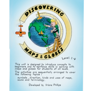
DISCOVERING MAPS & GLOBES Gr. 2-6
Introduce the salient concepts to beginners that reinforce skills in working with maps and globes. Designed for students with differentiated learning levels; including children who have had no experience in formal map & globe skills often experience difficulties when faced with geography as a subject at an intermediate level. The material in this package may be of benefit to children in junior and early intermediate grades as well. The activities are designed with participation in mind encou
Grades:
2nd - 6th
Types:
Mapping Skills with Google Earth: Map the World Gr. PK-2
**This is the chapter slice "Map the World" from the full lesson plan "Mapping Skills with Google Earth"** About the FULL RESOURCE:Teach your students the basics of map reading with our engaging resource designed for students in grades prekindergarten to two. Start with the elements found on a map, such as symbols, legends and the compass rose. Then, have your students apply what they’ve learned by mapping their classroom and route to school. Move on to the Great Lakes of North America and the s
Subjects:
Grades:
PreK - 2nd
Australia: Place Gr. 5-8
**This is the chapter slice "Place" from the full lesson plan "Australia"** About the FULL RESOURCE:Take your students on a journey through Australia, its countries, regions and cities by roadways and waterways. Understand its location relative to the rest of the world. Learn the interesting physical characteristics, wildlife, vegetation, population, and climates of the regions. Discover which human and environmental interactions are being made in Australia that impact world wide. Students will
Grades:
5th - 8th
Mapping Skills with Google Earth: Mapping Cultural Features Gr. 3-5
**This is the chapter slice "Mapping Cultural Features" from the full lesson plan "Mapping Skills with Google Earth"** About the FULL RESOURCE:Students will learn in-depth how to read and create maps with our engaging resource designed for students in grades three to five. Students will expand their knowledge of the elements on a map by exploring the lines of latitude, longitude and time zones. Then, students will learn about geographical and cultural features by exploring topographic and chorop
Subjects:
Grades:
3rd - 5th
Australia: Regions Gr. 5-8
**This is the chapter slice "Regions" from the full lesson plan "Australia"** About the FULL RESOURCE:Take your students on a journey through Australia, its countries, regions and cities by roadways and waterways. Understand its location relative to the rest of the world. Learn the interesting physical characteristics, wildlife, vegetation, population, and climates of the regions. Discover which human and environmental interactions are being made in Australia that impact world wide. Students wil
Grades:
5th - 8th
Mapping Skills with Google Earth: Map the World Gr. 3-5
**This is the chapter slice "Map the World" from the full lesson plan "Mapping Skills with Google Earth"** About the FULL RESOURCE:Students will learn in-depth how to read and create maps with our engaging resource designed for students in grades three to five. Students will expand their knowledge of the elements on a map by exploring the lines of latitude, longitude and time zones. Then, students will learn about geographical and cultural features by exploring topographic and choropleth maps. F
Subjects:
Grades:
3rd - 5th
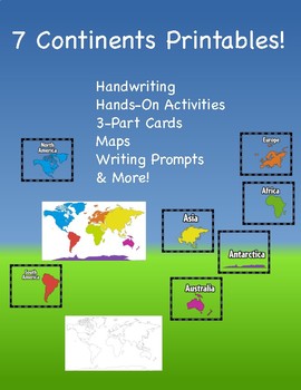
Seven Continents!
Students will learn about the seven continents through these worksheets.Montessori 3-part cards are included to be laminated. Students have traceable handwriting activities.Writing prompts for all continents are included.World map work utilizes coloring activities and identification.
Grades:
K - 1st
Also included in: Kindergarten Bundle of Fun...Math, Literacy, STEM & More!
Showing 1-24 of 30 results


