628 results
Middle school geography resources for Montessori
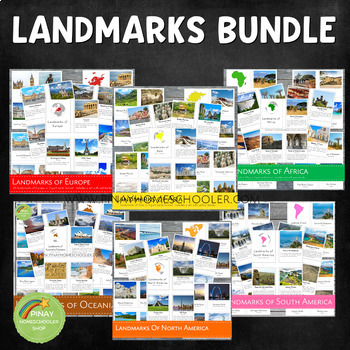
Landmarks Around the World Bundle Pack
This is a MEGA Montessori Bundle Pack, a big collection of landmarks around the world, which contains the following learning materials:✴ Landmarks of Australia/Oceania✴ Landmarks of Africa✴ Landmarks of Asia✴ Landmarks of Europe✴ Landmarks of North America✴ Landmarks of South America Be sure to check the individual files if you are just looking for one specific continent. We always use our printables at home in our homeschool journey. To see how it works, you are more than welcome to follow
Grades:
PreK - 6th
Types:
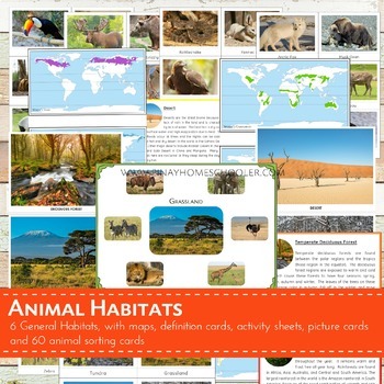
Montessori Inspired Animal World Habitats Learning Pack
I created this file for our geography and animal studies at home. We use this to study the different biomes (habitats) of the world and the animals that thrive on it. This printable is suitable for SORTING ACTIVITIES as well. The pictures I provided are big and clear enough for classroom discussion or for private use.
This file contains the following:
- 6 pictures of habitats (desert, temperate deciduous forest,
grassland, tundra, taiga, rainforest)
- 60 picture cards of animals (10 animals
Subjects:
Grades:
PreK - 6th
Types:
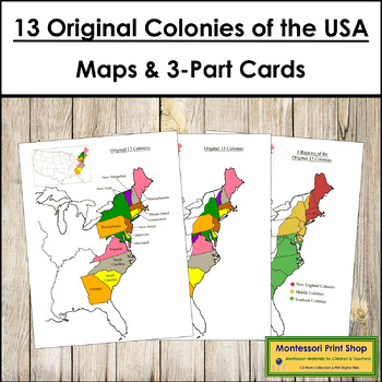
13 Original Colonies of the United States Maps, 3-Part Cards & Information
13 Original Colonies of the United States Maps & Information -Includes the following maps of the 13 original colonies of the USA as the states are divided today. The color maps are colored using the traditional Montessori map colors.Includes:1 black and white blank map1 black and white labeled map1 colored blank map1 colored and labeled map3 regions of the 13 colonies (includes maps for each of the 3 regions)It also includes the following maps of the 13 original colonies of the USA as the st
Grades:
3rd - 6th
Types:
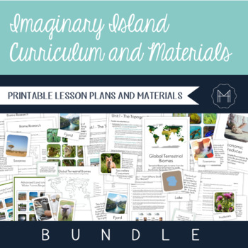
Imaginary Island Curriculum and Materials Bundle!
The beauty of Montessori lessons can be seen in how seamlessly they build on one another, guiding the child to true comprehension. Though this is generally highlighted in the Montessori math and language curricula, a beautiful sequence can be seen as the child makes their way through the cultural curriculum as well. Preparation for the Imaginary Island Study begins in the Children’s House. It is here that they are introduced to basic land and water forms, the complexity of which extends as they
Subjects:
Grades:
3rd - 7th
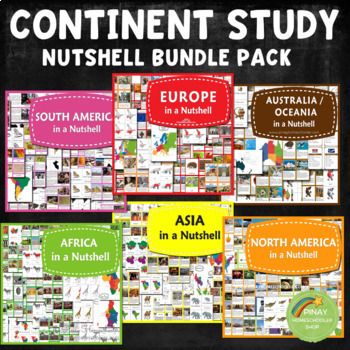
Continent Study Nutshell Geography Series Bundle
It contains all the learning materials in my Nutshell series.NORTH AMERICA IN A NUTSHELL (2022 UPDATED!)⭐ Montessori North America Continent Maps in blue and white background⭐ North American country locator maps and in the blackline format⭐ Countries Fact Cards for North America and in blank format⭐ 24 Country Flags of North America3 Part Cards FormatBlackline Masters⭐ Parts of American Alligator Nomenclature Cards with activity sheets⭐ 10 North America Plants in 3 Part Cards formatMap Locations
Subjects:
Grades:
K - 6th
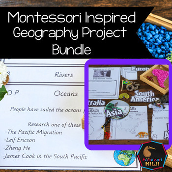
Geography Projects Bundle
Elementary Geography Projects and research tasks. This bundle of Geography tasks are the perfect supplement to Social Studies programs to help extend cultural and physical knowledge of countries and continents.These activities and task cards will extend your students knowledge and allow opportunities for students to integrate their knowledge and connect between curriculum areas. This bundle includes-21 task cards with projects for students to do related to Geography Curriculum-50+ pages of Conti
Subjects:
Grades:
3rd - 6th
Types:
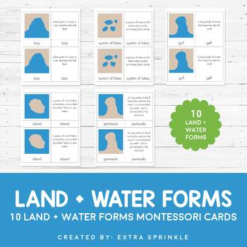
Land and Water Forms Montessori Cards
Check out my other MONTESSORI CARDSDear Educator,Thank you for purchasing the Land and Water Forms Montessori Cards. This set of nomenclature cards is an engaging way to teach your children about the various land and water forms.Included in this packet you will find 10 land and water forms represented:- bay- cape- gulf- peninsula- strait- isthmus- systems of lakes- archipelago- lake- islandFor each type or land and water form, there are TWO types of Montessori nomenclature cards. One card featur
Subjects:
Grades:
2nd - 6th
Types:
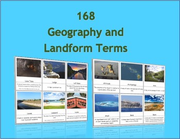
168 Geography and Landform Terms Flash Cards / 3 Part Montessori Cards
These cards align with most state standards and Classical Conversations Challenge A program. Additionally, these cards include terms specifically related to Hawaii's geography features such as windward, lava tube, etc. (Please see list below for a full list of terms.)The cards contained in this packet can be used as traditional flashcards or 3 Part Cards. The 3-Part Cards are Montessori inspired. Rote memorization can be difficult for children with dyslexia. The purpose of these cards is to as
Subjects:
Grades:
3rd - 12th
Also included in: Geography Terms Classical Conversations Aligned Bundle
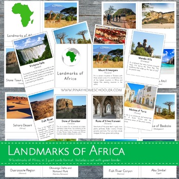
Montessori Inspired Landmarks of Africa 3 Part Cards and Fact Cards
This educational resource includes 20 real and high-quality images of famous landmarks in Africa, presented in a 3-part card format. The file is in a .zip format and includes two PDF files: (1) Landmarks of Africa with a green border, and (2) Landmarks of Africa without borders. Each file includes:- 20 control cards (picture and label)- 20 picture cards- 20 labels- title cards- 20 fact cards- added pin flagsTHIS FILE IS PART OF A BIGGER BUNDLE, which includes all LANDMARKS in continents of Asia
Subjects:
Grades:
PreK - 6th
Types:
Also included in: Landmarks Around the World Bundle Pack
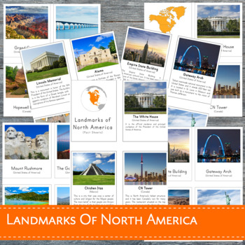
Montessori Landmarks of North America 3 Part Cards
This learning material features 23 high-quality REAL images of known landmarks in North America in 3-part cards format. This file is in a .zip form and contains 2 PDF files: (1) Landmarks of North America with BORDER (2) Landmarks of North America without border. Each file includes:- 23 control cards (picture and label)- 23 picture cards- 23 labels- title cards- 23 fact cards- added pin flagsDOES NOT INCLUDE A NORTH AMERICA MAPTHIS FILE IS PART OF A BIGGER BUNDLE, which includes all LANDMARKS i
Subjects:
Grades:
PreK - 6th
Types:
Also included in: Landmarks Around the World Bundle Pack
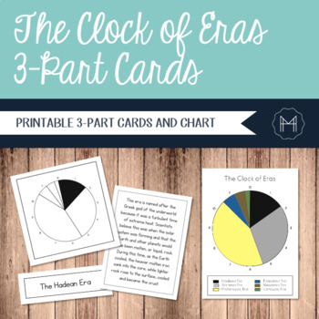
The Clock of Eras 3-Part Cards
Time can be an incredibly abstract topic for children to really grasp. For this reason, many Montessori cultural materials begin with an impressionistic lesson involving a timeline. Whether the students are creating a timeline of their own lives or diving into a study of the history of writing, a physical representation can make the abstract far more concrete.The Clock of Eras work is introduced after the First Great Lesson has been presented. The children have started their independent research
Grades:
2nd - 6th
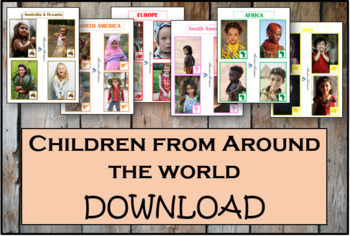
Children From Around The World - Montessori
As children work with these cards, they'll discover fascinating details about the lives and histories of people around the world. These Montessori-inspired children around the world cards will be a good fit to any classroom.This Montessori material is a part of peace education. The material consists of series of cards showing children of different nations, nationalities and races around the world. Each card contains a small map of the continent. There are 54 cards in the Download.
Subjects:
Grades:
PreK - 12th, Higher Education, Adult Education, Staff
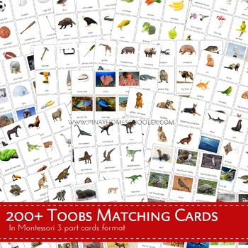
300+ Toobs Matching Cards Bundle Pack
IMPORTANT NOTICE: I am currently updating the files, so please pardon me if some of the Safari Toob Sets you are looking for are missing. They will be included. Remember that purchasing this bundle allows you to access to ALL OF OUR SAFARI TOOB PRINTABLES 3 PART CARDS. If you are looking for a missing file and need it immediately, (based on the previous old pack) please send me an email at pinayhomeschooler@gmail.com.============================================================================
Subjects:
Grades:
PreK - 6th
Types:
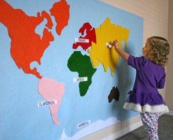
World Continent Map - Interactive on Felt or Paper, 3x5 ft.
Make an interactive 3 ft by 5 ft map on felt or paper.
File includes full 3x5' image, as well as tiles to print on 11x17" paper. Print right on colored paper, or on white paper as template to create felt map. Continents are colored for Montessori.
Not a DIYer? Buy the product and skip the template: https://www.etsy.com/listing/217193390/felt-map-of-world-continents-kid-baby
Pairs well with this spinning wheel and worksheet:
https://www.teacherspayteachers.com/Product/Montessori-Continents-Sp
Subjects:
Grades:
PreK - 6th
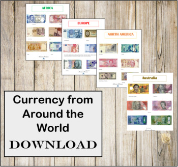
Currency from Around the World- Instant Download- Montessori
CURRENCY FROM AROUND THE WORLD INSTANT DOWNLOAD.There are 6 individual high resolution photos of different banknotes for countries around the world! This is a great addition to any Continent bag or Continent box. These photos are in regulations with the Department of Treasury for printing.
Subjects:
Grades:
PreK - 12th, Higher Education, Adult Education, Staff
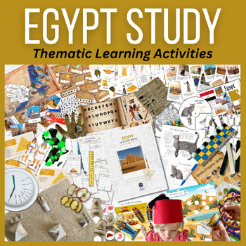
EGYPT Activity BUNDLE Hands-on Activities, Ancient Experiments, Models & Culture
Travel through educational activities with this fresh interactive educational bundle of activities featuring EGYPT! Included is an informational placemat poster and country flag, as well as major landmarks, three-part cards and geographical pinning work. Learn fun facts about this amazing country as well as the fauna. See major historical events of Egypt and color a digital rendition of an ancient Egyptian calendar. Create your own 3D paper diorama of the Giza Plateau, complete with the three gr
Grades:
K - 6th
Continent activities and projects
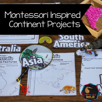
World Geography Continent work. These open ended social studies projects will help your students learn about continents by learning about Cultural geography and physical geography continent work. Suitable for children in Montessori Elementary or public school classrooms.These activities encourage students to undertake geography projects either independently or in groups! Many of these projects integrate into other Social studies or science topics.Each continent has several projects. The project
Subjects:
Grades:
4th - 6th
Also included in: Geography Projects Bundle
Imaginary Island Scope and Sequence
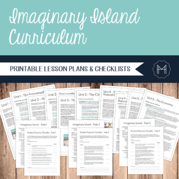
The beauty of Montessori lessons can be seen in how seamlessly they build on one another, guiding the child to true comprehension. Though this is generally highlighted in the Montessori math and language curricula, a beautiful sequence can be seen as the child makes their way through the cultural curriculum as well. Once they have reached upper elementary, the child combines their previous lessons and exploration into one, culminating project: The Imaginary Island. This integrates the concepts o
Subjects:
Grades:
3rd - 7th
Also included in: Imaginary Island Curriculum and Materials Bundle!
Cosmic HISTORY: Ancient World, Three Revolutions, First Nations, U.S. History
Cosmic HISTORY: Ancient World, Three Revolutions, First Nations, U.S. History, Global Influences (and much more!) BUNDLE - Elementary, Montessori-inspired History & Geography Resources for the Classroom or for your Homeschool!Montessori-inspired history & geography resources: What a time saver! From the Ancient World and Language & Math Great Lessons, to Three World Revolutions, First Nations, and American History. This bundle will help you cover an entire school year!Suggested Order
Grades:
4th - 7th
Types:
ANTARCTICA South Pole Continent Study Bundle | Expeditions, Penguins, Glaciers
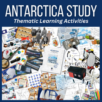
Travel to the continent of Antarctica from the comfort (and warmth) of home. This interactive activity bundle includes our signature Info Poster, Flag & Historical Timeline of Antarctic Exploration. Learn fun facts about this incredible continent with our sixteen ring cards, featuring full color illustrations.Learn about some of the research stations of Antarctica from countries around the world. Each card includes flag and a small writeup about each, including a location for each. Pin these
Grades:
K - 6th
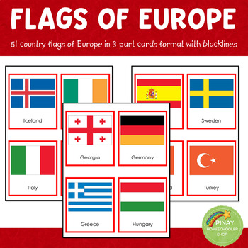
Montessori European Flags in 3 Part Cards and Blackline Masters
MONTESSORI EUROPE FLAGS 3 PART CARDSThis file contains 51 flags of Europe in red-bordered and no-bordered sets. This pack includes the following: ➥ 51 (3-part-card flags) with no border ➥ 51 (3-part-card flags) with red border ➥ 51 blackline master for coloring activities ➥ instruction on how to use the material⭐THIS IS PART OF A BUNDLE⭐This is part of the EUROPE IN A NUTSHELL learning pack. Please don't purchase if you own already own the said learning pack.NOTE: The flag set includes Euroa
Grades:
PreK - 12th
Types:
Also included in: Montessori Country Flags Bundle - COMPLETE
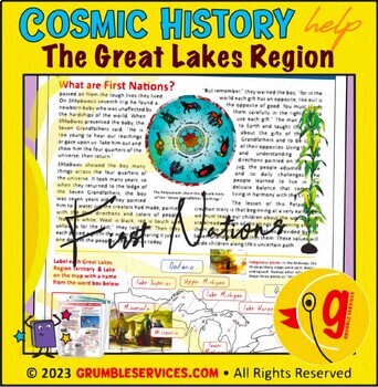
First Nations: Great Lakes Native American Tribes, Midwest Region Social Studies
First Nations: Great Lakes Native American Tribes, Midwest Region Social Studies • Potawatomi, Ho-Chunk, Menominee Tribes • SEMiPRO Elementary Montessori-inspired History & Geography help (5 printable pages + key): Who were the Menominee, Ho-Chunk and Potawatomi Indigenous Peoples? This learning resource will help guide young historians to:Learn who the Indigenous Menominee & Ho-Chunk Nations are and where they have livedFollow the journey of the Potawatomi along the Great Lakes and conn
Grades:
4th - 6th
Types:
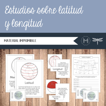
SPANISH - Estudios sobre latitud y longitud
El estudio de la geografía ayuda a inculcar una mayor comprensión y apreciación de las complejidades y la belleza del mundo físico que nos rodea. Estas tarjetas de nomenclatura introducen al niño(a) a los siguientes términos:• Latitud• Longitud• Meridiano cero• Ecuador• Hemisferio norte• Hemisferio sur• Hemisferio Oriental• Hemisferio OccidentalContenidoPágs. 2-5: Latitud y longitud – Tarjetas de 3 partesPágs. 6-7: Latitud y longitud – Tarjetas de 3 partes - ControlPágs. 8-15: Posters de latitud
Subjects:
Grades:
3rd - 6th
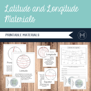
Latitude and Longitude 3-Part Cards, Posters, and Task Cards
The study of geography helps to instill a greater understanding and appreciation for the intricacies and beauty of the physical world around us. These nomenclature cards introduce the child to the following terms:•Latitude•Longitude•Prime Meridian•Equator•Northern Hemisphere•Southern Hemisphere•Eastern Hemisphere•Western HemisphereContentsPgs. 2-5: Latitude and Longitude 3-Part CardsPgs. 6-7: Latitude and Longitude 3-Part Cards ControlPgs. 8-15: Latitude and Longitude PostersPgs. 16-17: How to I
Subjects:
Grades:
3rd - 6th
Also included in: Imaginary Island Curriculum and Materials Bundle!
Showing 1-24 of 628 results


