36,279 results
11th grade Thanksgiving geography resources
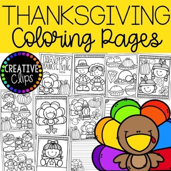
Thanksgiving Coloring Pages (+ writing papers) {Fall Coloring Pages}
This 19-page coloring book includes 2 covers, 14 unique coloring pages as well as 3 coordinating writing papers that offer differentiation for your little writers. Use these pages for story starters, early finishers, indoor recess, parties, writing prompts and more!This coloring book is NOT included in any of my Coloring Book Bundles.This product is for PERSONAL USE only and cannot be copied, redistributed or posted for others. Check out my other coloring books to see examples of the quality gra
Subjects:
Grades:
PreK - 12th, Staff
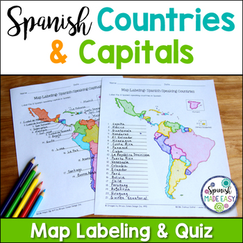
Spanish-Speaking Countries and Capitals Maps and Quiz
This is a map labeling activity and matching quiz over the 21 Spanish-speaking countries and capitals. Students will label and identify the 21 Spanish-speaking countries and capitals in Spanish. This is a great activity when reviewing Spanish-speaking countries and capitals or Spanish geography. Makes a great coloring page. Answer keys are included.
Countries included:
España, México, Costa Rica, El Salvador, Guatemala, Honduras, Nicaragua, Panamá, Cuba, La República Dominicana, Puerto Rico, Ar
Subjects:
Grades:
6th - 12th
Also included in: Spanish Countries and Capitals Geography Bundle
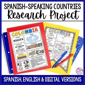
Spanish Speaking Countries Project Research a Country with Google Slides Digital
This Spanish-Speaking country project is an organized and efficient way for students to research Spanish-speaking countries. The templates are in both English and Spanish and can be completed digitally or handwritten. Includes digital templates for PowerPoint and Google Slides.*can easily be adapted for other languages, geography, or social studies classesThis project to create an infographic for a country includes:-Templates in 3 different designs-English templates-Spanish templates-Completed
Subjects:
Grades:
6th - 12th
Types:
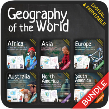
Geography of the World (Bundle)
Let’s learn about the Countries, Capitals and Geographic Features of the World! The World’s countries, capitals, geographic features, and attractions are addressed in these units with a wide variety of fun activities such as puzzles, crosswords, word searches, gap-fills and many others. GOOGLE SLIDES WITH PREMADE TEXTBOXES INCLUDED! The units also include additional map quizzes of different levels, maps, answer sheets and answer keys. BONUS: EXTRA REFLECTION MATERIALS THAT COVER ALL UNITS! You
Subjects:
Grades:
6th - 11th
Types:
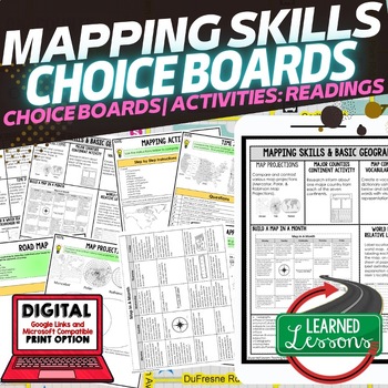
Geography Mapping Skills Activities, Geography Choice Board, Reading Passages
Mapping Skills and Basic Geography Choice Boards, Mapping Skills Readings Google Classroom, Print & Digital Learning provides differentiated activities to use with students to master the content. THIS IS ALSO PART OF SEVERAL BUNDLES World Geography MEGA BUNDLE AND World Geography Choice Board Activity BUNDLE AND Mapping Skills BUNDLE Choice Board Activities and Mapping Skills Readings Including the following: Mapping ActivityCartographerMap ScaleTypes of MapsTime ZonesRoad MapsLand and Wate
Grades:
7th - 12th
Types:
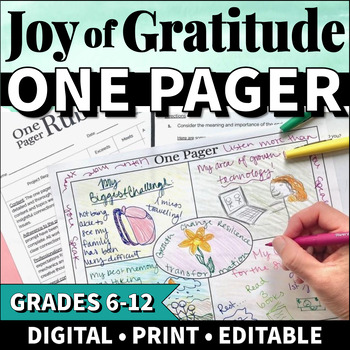
Gratitude Activities Middle School Thanksgiving Activities High School SEL
Use this EDITABLE, NO PREP, GOOGLE SLIDES gratitude one pager activity to help your middle school or high school students celebrate Thanksgiving and experience the joy of gratitude! This fun, creative, and engaging 1 pager activity encourages students to reflect on the people, experiences, and things they have to be grateful for.The activity is formatted to be printable as well as digital.What is included in this resource?Teacher Guide: Directions for teachers facilitating this activity. Include
Grades:
6th - 12th
Types:
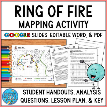
Ring of Fire Mapping Activity and Questions - Earthquakes and Volcanoes
⭐ ⭐ ⭐ ⭐ In this fun and engaging ring of fire mapping activity, students plot the coordinates of past earthquakes and volcanoes along the ring of fire using an easy to read Pacific-centered world map. Students will then draw other geologic features on their maps such as trenches, mountain ranges, hot spots, and mid-ocean ridge. After the map is complete, students will answer 25 analysis questions. Editable MS Word version, PDF version, and Google Slides version are all included!I complete this w
Subjects:
Grades:
8th - 12th
Types:
NGSS:
MS-ESS2-3
, HS-ESS2-1
, MS-ESS2-2
, HS-ESS1-5
Also included in: Plate Tectonics Growing Discount Bundle
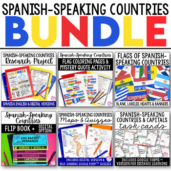
Spanish Speaking Countries BUNDLE Project Maps Flip Book Quizzes + DIGITAL
This money-saving bundle has everything you need to teach the Spanish-speaking countries, their locations, and capitals! Includes maps, quizzes, project, activities, and more! Save over 30% on this bundle of the following items:Spanish-Speaking Countries Flip BookNo cut, no waste, 6 page / 3 pieces of paper printable flip bookDigital flip book in Google Slides for paperless or distance learningWestern Europe map to label SpainWest Africa map to label Equatorial GuineaCentral America / North Am
Subjects:
Grades:
6th - 12th
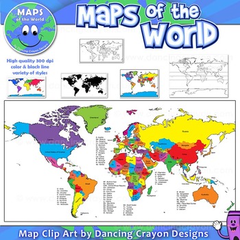
Maps of the World: Clip Art World Maps
Maps of the World: Clip Art World Maps
High quality color and black and white maps of the world.
This clipart map set contains the following commercial use graphics:
- Color maps of the world
- Black and white line art maps of the world
- Maps of the world with lines of latitude and without lines of latitude
- Maps of the world with larger countries labelled (color and black and white)
- Silhouette maps of the world
- A map of the world showing seven continents in color and black and white:
Grades:
3rd - 12th, Higher Education, Adult Education, Staff
Also included in: Maps of the World Clip Art - MEGA-BUNDLE
Global Issues Contemporary World Problems Human Geography Course Bundle
This tightly-woven semester course combines Human Geography, Current Events, Contemporary World Issues, and Environmental Science into a must-teach inquiry-driven, real-world, project-based experience.With these thematic, inquiry-driven units that build on each other, ask students to decide for themselves where they fit in this complex, competitive, and connected global village. You will guide them in exploring everything from the human population growth to globalization to natural resource sust
Subjects:
Grades:
9th - 12th
Types:
CCSS:
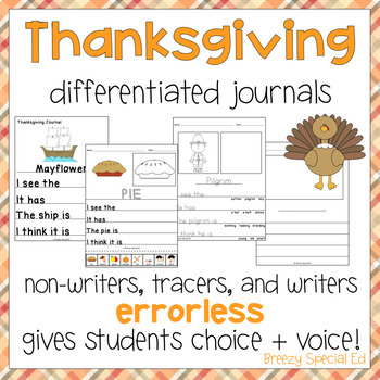
Fall and Thanksgiving Journals - Differentiated Writing Activity for Special Ed
With three different levels included, this fun Thanksgiving Journal pack is perfect for your special education class. It's already differentiated for all of your students, including non-writers, emerging writers, and writers! This journal prompt pack is about all things related to Thanksgiving / Fall time, including a turkey, apples, pilgrims, and more! There are 10 leveled journals included, enough to get you through 2 full weeks if you do a journal each day.*Looking for more Thanksgiving resou
Subjects:
Grades:
PreK - 12th
Types:
Also included in: The Mega Thanksgiving Bundle for Special Education
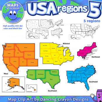
Regions of the USA: Five Regions - Map Clip Art
Regions of the USA: Five Regions - Map Clip Art
.............................................................................................
Please check the regions in this set before purchase. We offer a choice of THREE different US Region Map Sets:
USA divided into FOUR regions / NINE divisions (as set out by the United States Census Bureau)
USA divided into FOUR regions / TEN divisions (as taught in some states)
Please read on for more information about THIS region set:
............
Grades:
3rd - 12th, Staff
Also included in: Maps of the World Clip Art - MEGA-BUNDLE
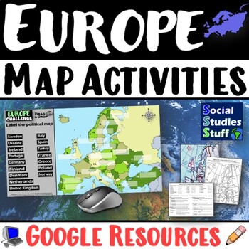
Geography of Europe Map Practice Activities | Print and Digital | Google
End the cycle of bored students copying from books to label maps! Your classes think critically with these digital, interactive, geography activities. First, students answer questions about Europe by analyzing various physical & political maps of the region. Then, a drag & drop challenge assesses their learning of the locations. This resource also includes a printable worksheet that takes labeling maps to the next level! They create a map using only absolute & relative location clues
Subjects:
Grades:
5th - 12th
CCSS:
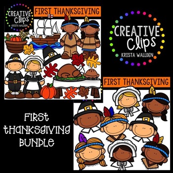
First Thanksgiving {Creative Clips Digital Clipart}
This 50-piece set is perfect for your Thanksgiving-themed resources! Included are 31 vibrant, colored images and 19 black and white versions (not shown in the preview).
Included are:
- Native American boy
- Native American girl
- pilgrim boy
- pilgrim girl
- Mayflower
- table
- cooked turkey
- pie
- harvest basket
- leaves (two versions in various colors)
- pilgrim hat
- pumpkin
- Native American faces (boy and girl)
- pilgrim faces (boy and girl)
The images will have high resolution, so you
Subjects:
Grades:
PreK - 12th, Staff
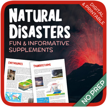
Natural Disasters
Let's learn about Natural Disasters! This worksheet includes 34 pages with a large variety of activities and exercises about natural disasters. Crosswords, word searches, puzzles and other kinds of activities are included to make it a fun and interesting class. The answers and an answer sheet are included. GOOGLE SLIDES AND FILLABLE PDF VERSIONS INCLUDED!Overview: Page 1-2: Introduction Page 3-4: EarthquakesPage 5-7: HurricanesPage 8-9: FloodsPage 10-11: Volcanic EruptionsPage 12-13: TsunamisPag
Subjects:
Grades:
5th - 12th
Types:
Also included in: Geography Bundle (Nature, Oceans, Ecosystems, and Natural Disasters)
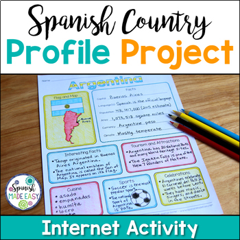
Spanish Country Profile Project
This is a country profile project over the 21 Spanish-speaking countries. Students will research important geographical and cultural facts about each country. This activity includes a blank country profile template, a template for each country, a list of Spanish-speaking countries, and a grading rubric in both English and Spanish. Research topics include: Countries flag, map, capital, language(s), population, area, currency, climate, interesting facts, tourism and attractions, cuisine, sports, a
Subjects:
Grades:
2nd - 12th
Types:
Also included in: Spanish Countries and Capitals Geography Bundle
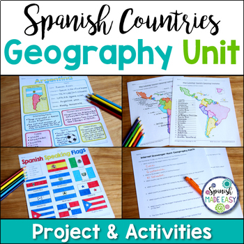
Spanish Countries and Capitals Geography Bundle
This is a Geography Unit with 4 resources over the 21 Spanish-Speaking Countries and Capitals. In this bundle you will receive a Spanish-speaking country profile project, 2 map labeling activities, a matching quiz activity, an internet scavenger hunt, and a 2 page coloring activity with the 21 flags of the Spanish-speaking world. Answer keys and examples are included. Purchase this bundle and save over 25% off the following resources:Spanish-Speaking Country Profile ProjectSpanish-Speaking Count
Subjects:
Grades:
6th - 12th
Types:
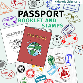
Passport Booklet & Stamps Growing Bundle: Around the World Unit, Geography Fair
These passport stamps and passport booklet are absolutely amazing!!! Perfect for an around the world unit, introduction to country studies, a Geography Fair, International Night, Social Studies Units, "Read Around the World" Passports, or Christmas Around the World (or Holidays Around the World). Save now by getting in early on this GROWING BUNDLE as we will be adding country stamps in the near future!The passport booklet is authentic, appropriate for students in any country ("Citizen of the Wor
Grades:
PreK - 12th
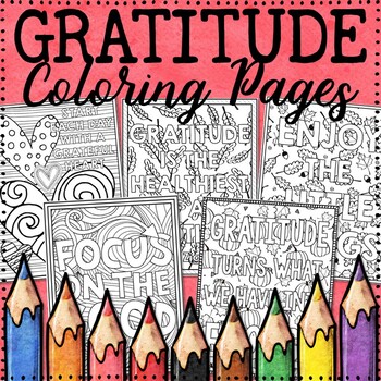
Gratitude Coloring Pages | Thanksgiving Coloring Pages
These 10 fun, no prep gratitude coloring sheets are designed to inspire students to focus on being grateful by featuring messages and quotes related to gratitude and detailed images that students will love to color. Writing pages are also included so students may respond to a quote or write about what they are grateful for. Coloring helps stimulate the brain, inspire positive thinking, keep one’s focus on the present moment, and more! Ideas for incorporating these coloring pages into the classro
Grades:
3rd - 12th
Types:
Also included in: HUGE Coloring Pages Growing Bundle
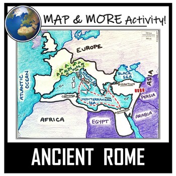
Ancient Rome Map Activity- Roman Empire (Label and Color!)
This Ancient Rome Map Coloring & Labeling Activity is a great resource to enhance your unit! Each student will make their own, personalized map of the Roman Empire, and learn about the geography and landmarks of the region. They will label and color their blank map, and answer follow-up questions related to the geography of Ancient Rome. A fun 'Make a Travel Brochure' project has also been added. It is a great way to connect this map activity to your lesson on Ancient Rome! A link to Goo
Grades:
4th - 11th
Types:
CCSS:
Also included in: Ancient Civilizations / World Maps BUNDLE- Color & Label Activities!
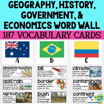
Social Studies Word Wall Vocabulary Cards, Bulletin Board Idea
This product is a word wall to help teach important social studies vocabulary words to students. It can also be used as a social studies bulletin board!The specific regions included are Europe, Australia, Latin America and the Caribbean, and Canada. However, the domains include geography, government, economy, and history, so this resource can be used in most social studies classrooms. Also, many terms are not specific to these regions and can be applied broadly.Each word card includes the vocabu
Grades:
3rd - 11th
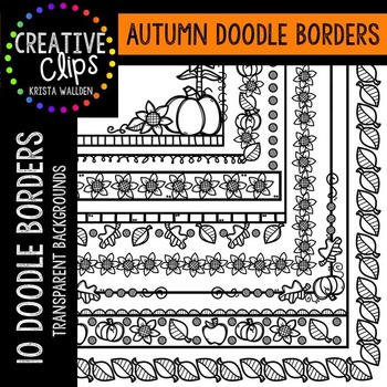
Autumn Doodle Borders {Creative Clips Digital Clipart}
This 10-image set is full of autumn-themed doodle borders!
Borders are blackline with transparent backgrounds.
The images will have high resolution, so you can enlarge them and they will still be crisp.
All images are in png formats so they can easily be layered in your projects and lesson materials.
Creative Clips Digital Clipart is created by Krista Wallden. Please read my Terms of Use regarding personal and commercial use of my graphics. You can download the free document here: CREATIV
Subjects:
Grades:
PreK - 12th, Staff
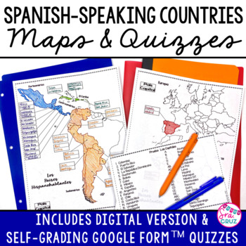
Spanish Speaking Countries and Capitals Maps and Quizzes Worksheet + DIGITAL
Spanish-Speaking Countries Maps and Quizzes - Included are blank maps of the Spanish-speaking countries for students to fill in, completed maps, a map quiz, and a matching capitals quiz. NEW: Now includes Google Slides™ version of the map for students to fill in digitally and self-checking Google Forms™ quizzes for the map and capitals quizzes.*Please see the thumbnails & preview for more details*Includes:✅ Blank Maps-One page map without Equatorial Guinea-Two page map with Equatorial Guinea
Subjects:
Grades:
6th - 12th
Apple Orchard and Apple Life Cycle Bundle {Creative Clips Digital Clipart}
This 56-piece bundle has everything you need for creating your favorite apple-themed lessons and resources for fall! Included are 35 vibrant, colored images and 21 black and white versions (not shown in the preview). This bundle has fun apple orchard images, as well as all the stages you would teach in the apple life cycle. Since these two topics are often taught together, I have bundled these two sets, rather than sell them separately. That way, you don't have to pay for repeated images in two
Subjects:
Grades:
PreK - 12th, Staff
Showing 1-24 of 36,279 results


