
UNITED STATES Coloring Pages Activity | State Capitals USA Regions Maps


- PDF
What educators are saying
Also included in
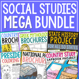 Save 50% on all the resources in this MEGA HISTORY BUNDLE! This HUGE collection includes over 150 resources including my top-selling USA Capitals and Abbreviations Interactive Notebook, World and American History Brochure Projects, Historical Figure Research Brochure Projects, Major War Posters, USAPrice $248.00Original Price $495.75Save $247.75
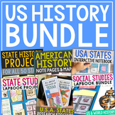 This bundle includes a huge variety of activities that will keep students engaged all year long! These projects work perfectly together as your students learn about the United States of America and dig into their own state history. At the end of the year, they'll end up with three keepsake projectsPrice $32.50Original Price $64.50Save $32.00
Description
(50) USA States Coloring Pages. This booklet contains one page per state. Encourage your students to research facts about the states and write them around the state shape. My FAVORITE way to use these pages is as a note taking/doodle sheet. We use a YouTube video about a state, then write 4 - 5 facts from the film and draw a few points of local interest. EASY, engaging activity! These coordinate perfectly with my larger state notebook journal projects - there's one for each of the 50 states!
NEED A CUSTOM STATE JOURNAL PROJECT? CLICK ON YOUR STATE BELOW:
Terms of Use Copyright © Project Based Learning with Elle Madison. All rights reserved by author. This product is to be used by the original downloader only. Copying for more than one teacher, classroom, department, school, or school system is prohibited. This product may not be distributed or displayed digitally for public view. Failure to comply is a copyright infringement and a violation of the Digital Millennium Copyright Act (DMCA). Clipart and elements found in this JPEG are copyrighted and cannot be extracted and used outside of this file without permission or license. Intended for classroom and personal use ONLY.
Tags:
Alabama, Alaska, Arizona, Arkansas, California, Connecticut, Colorado, Delaware, Florida, Georgia, Hawaii, Idaho, Illinois, Indiana, Iowa, Kansas, Kentucky, Louisiana, Maine, Maryland, Massachusetts, Michigan, Minnesota, Mississippi, Missouri, Montana, Nebraska, Nevada, new Hampshire, New Jersey, New Mexico, New York, North Carolina, North Dakota, Ohio, Oklahoma, Oregon, Pennsylvania, Rhode Island, South Carolina, South Dakota, Tennessee, Texas, Utah, Vermont, Virginia, Washington, West Virginia, Wisconsin, Wyoming, ready to print, geography, social studies, US history, state history, government, economics, elementary, middle school, high school, homeschool, special education, state map, USA, United States of America, President
