TPT
Total:
$0.00

Weather Map Project- STEM Meteorology

Rated 4.74 out of 5, based on 23 reviews
4.7 (23 ratings)
;
Surfing and STEM
469 Followers
Resource Type
Standards
Formats Included
  • PDF
Pages
73 pages
$4.00
$4.00
Share this resource
Report this resource to TPT
Surfing and STEM
469 Followers

What educators are saying

I used this with my weather video reports and we used them for our digital backgrounds! This was amazing! Would purchase again!

Description

PLEASE READ BEFORE PURCHASING!

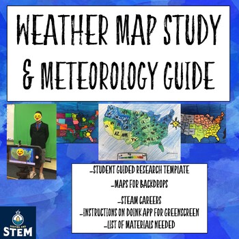
This is *NOT* a "no prep" activity. It requires a green screen, if used in the way photos appear, and the downloading of an app from an Iphone. In addition, there are other item like a tripod I suggest you purchase to complete this. It also requires at least two hours of time on the teacher's part to prepare your students for this activity. However, it is completely worth the time and money. This took my students about three days (one hour each day) to complete, after this activity, the knew their weather maps forward and backwards from studying weather patterns, seeing the signs on maps, and knowing what they meant. It will not disappoint!

This is a perfect addition to use with your activities on the water cycle and weather map studies. It requires students to study and research the location of your choice, figure out a typical week of weather, and deliver a green screen report on it. The maps, script guide, and everything your students need is in this packet. As long as you order the items well enough in advance, it should cost you under $40 and all the items can be reused every year!

See my products in action on Instagram!

Connect with me on Pinterest!

Total Pages
73 pages
Answer Key
Does not apply
Teaching Duration
3 days
Report this resource to TPT
Reported resources will be reviewed by our team. Report this resource to let us know if this resource violates TPT’s content guidelines.

Standards

to see state-specific standards (only available in the US).
NGSSMS-ESS2-4
Develop a model to describe the cycling of water through Earth’s systems driven by energy from the sun and the force of gravity. Emphasis is on the ways water changes its state as it moves through the multiple pathways of the hydrologic cycle. Examples of models can be conceptual or physical. A quantitative understanding of the latent heats of vaporization and fusion is not assessed.
NGSSMS-ESS2-5
Collect data to provide evidence for how the motions and complex interactions of air masses result in changes in weather conditions. Emphasis is on how air masses flow from regions of high pressure to low pressure, causing weather (defined by temperature, pressure, humidity, precipitation, and wind) at a fixed location to change over time, and how sudden changes in weather can result when different air masses collide. Emphasis is on how weather can be predicted within probabilistic ranges. Examples of data can be provided to students (such as weather maps, diagrams, and visualizations) or obtained through laboratory experiments (such as with condensation). Assessment does not include recalling the names of cloud types or weather symbols used on weather maps or the reported diagrams from weather stations.
NGSS4-ESS2-2
Analyze and interpret data from maps to describe patterns of Earth’s features. Maps can include topographic maps of Earth’s land and ocean floor, as well as maps of the locations of mountains, continental boundaries, volcanoes, and earthquakes.

Reviews

Questions & Answers

469 Followers