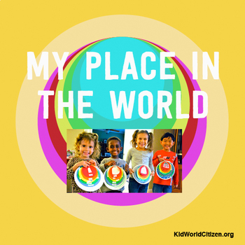
My Place in the World Project: "Me on the Map" Geography for Kids
- PDF
What educators are saying
Also included in
- We have combined our three BEST-SELLING geography for kids activities into one essential bundle! These hands-on activities are a fantastic way to introduce geography to kids who are still learning the basics.ACTIVITY 1: My Place in the World Complementing "Me on the Map," the hands-on geography proPrice $5.00Original Price $6.50Save $1.50
Description
This hands-on geography project "My Place in the World" has kids create a visual representation of how we fit into the world. Teachers often use it with the kids' geography book "Me on the Map," by Joan Sweeney. Ideal for integrated Social Studies, ELA, Geography, Literacy, and Map Skills.
Using a series of nesting circles to show the relative sizes of different geographic places, this simple but effective geography lesson helps kids sort out their relation to one another.
This activity includes:
- a series of pre-labeled concentric circles for kids to cut out and decorate
- a series of unlabeled concentric circles for kids to cut out, label, and decorate
- a series of maps (see below!) that kids can cut out and use, or use as a reference in drawing their own geographic locations
In this unique geography craft, students will:
- cut out circles
- draw pictures for "My house," "My city"
- color in the provided maps for "My state," "My country," "My continent," and "My planet."
- connect them with a brad or ring in order from smallest to largest
This set includes outline maps for all provinces and states in the UK, Australia, United States, and Canada. It can be easily adjusted for any location in the world. It can be used in a community unit, a social studies class, a foreign language or ESL class, or a lesson as children are learning their personal information.
This is a craftivity that works with interactive notebooks, lapbooks, bulletin boards, as a stand alone flip book.
See it in Action on the KidWorldCitizen.org blog!!
This geography art project is one of the most popular activities on KidWorldCitizen.org. This activity is a favorite among teachers of all grade levels. See it in action here: http://kidworldcitizen.org/2011/11/26/my-place-in-the-world-project/
MAPS INCLUDED:
Earth
"My Planet" with 2 choices of views (Eastern Hemisphere and Western Hemisphere)
Continents
- Europe
- North America
- Australia/Oceania
Countries
- US
- Canada
- UK
- Australia
States/Territories:
United States
- Alabama - AL
- Alaska - AK
- Arizona - AZ
- Arkansas - AR
- California - CA
- Colorado - CO
- Connecticut - CT
- Delaware - DE
- Florida - FL
- Georgia - GA
- Hawaii - HI
- Idaho - ID
- Illinois - IL
- Indiana - IN
- Iowa - IA
- Kansas - KS
- Kentucky - KY
- Louisiana - LA
- Maine - ME
- Maryland - MD
- Massachusetts - MA
- Michigan - MI
- Minnesota - MN
- Mississippi - MS
- Missouri - MO
- Montana - MT
- Nebraska - NE
- Nevada - NV
- New Hampshire - NH
- New Jersey - NJ
- New Mexico - NM
- New York - NY
- North Carolina - NC
- North Dakota - ND
- Ohio - OH
- Oklahoma - OK
- Oregon - OR
- Pennsylvania - PA
- Rhode Island - RI
- South Carolina - SC
- South Dakota - SD
- Tennessee - TN
- Texas - TX
- Utah - UT
- Vermont - VT
- Virginia - VA
- Washington - WA
- West Virginia - WV
- Wisconsin - WI
- Wyoming - WY
Canadian provinces and territories
- Alberta
- British Columbia
- Manitoba
- New Brunswick
- Newfoundland and Labrador
- Northwest Territories
- Nova Scotia
- Nunavut
- Ontario
- Prince Edward Island
- Quebec
- Saskatchewan
- Yukon
Australian states and territories
- New South Wales
- Queensland
- South Australia
- Tasmania
- Victoria
- Western Australia
- Australian Capital Territory
- Northern Territory
*************************************************************************
Three Best-Sellers in our Geography for Kids Bundle
Get this activity along with two others in our Geography for Kids Bundle!
The packet includes:
*Map the Route Activity
*My Place in the World
*Learn the Continents and Oceans
Buy all three geography activities and save!
*************************************************************************
Be the first to know about my new discounts, freebies and product launches:
Look for the green star next to my store logo and click it to become a follower. Voila! You will now receive email updates about this store. ☺


