Me on the Map Printable Activities | Back to School | All About Me
- Zip
Description
Use this hands-on, interactive Me on the Map unit to help students learn all about where they live. This adorable flip-book will make a great bulletin board any month of the year, especially for open house. Use the other printables or worksheets in your social studies interactive notebook.
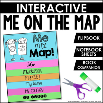
Me on the Map flip-book
•Me: Students will write their name, age, school, grade, teacher, and illustrate a picture of themselves
•My Street: Students will draw a picture of their street and write about it (open ended). A place is given for students' to write their address.
•My Town or My City: Students will draw a picture of their town/city and write about it (open ended). A place is given for students' to write their town/city name.
•My State: Students will illustrate and label the following items for their state: flower, tree, mammal, bird, insect, and fish. Students will draw a picture of their state and label.
•My Country: Students will color a map of the United States of America. Students will label their country and write about it (open ended).
•My World: Students will color a picture of Earth and label it. Students will write about their planet (open ended).
★Terminology for each flip-book page was based off of the book, "Me on the Map!" by Joan Sweeney. The book does not use the word "continent" or explain it. Due to this, I have NOT included a flip-flap book based on continent ★
Interactive Sheets All sheets can be used in a notebook or on construction paper.
•Street: Students will illustrate a picture of their street. Students will list/explain things they see and hear on their street. Students will write about their street (opened ended).
•Town/City: Students will illustrate a picture of their town/city. Students will label their town/city. Students will list things they see or places they go. Students will write about their town/city (open ended).
•State: A cut/paste sheet of EACH state is provided! Students will cut/paste their state on the frame. This map can be used to add cities, rivers, mountains, etc. Students will write 3 facts about their state. Students will list their state's bird, flower, insect, and tree.
•Country: Students will color a map of the USA. This is a great place to point out where your state is located! Students will label their country. Students will color the USA's flag. Students will learn how many stars and stripes are on each flag. Students will label/draw the nation's bird and flower.
•Continent: Students will color a map of North America. Students will label North America. Students will color and label the other 6 continents.
•World: Students will color a map of Earth and label. Students will read facts about Earth. Students will write about what they know about Earth (open ended).
✔This is a zipped file. In this file, you will receive one PDF with everything listed above & one PDF that contains just the state printables for easy printing!


