GEOGRAPHY | USA & World Maps | 135 Map Labeling Tasks (Gr. 3-7)
- Zip
What educators are saying
Also included in
- Language Arts Bundle (4th, 5th, 6th Grade).Fan yourself like Cleopatra, as kids awe in disbelief of your hundreds of language arts worksheets and many random freebies. Follow listing links for previews.Price $6.39Original Price $106.71Save $100.32
- US History Bundle (4th, 5th, 6th Grade).A US History bundle with 200 worksheets and 400 images for upper elementary, with many random freebies.Preview is typical of Download, or follow links for full previews. *Tip: This bundle is based on the first product listed (American History Worksheets). ThePrice $5.59Original Price $218.42Save $212.83
- Geography Bundle (4th, 5th, 6th Grade).A geography bundle of worksheets and images for upper elementary, with many random freebies.Preview is typical of Download, or follow links for more previews.*Tip: This geography bundle is based on the first two products listed. The other bundle products are inPrice $5.59Original Price $105.04Save $99.45
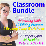
- Classroom Bundle - Bundles. Spend less time thinking of lessons and more time reading People magazine. This Classroom Bundle contains the following: 135 Map Labeling Tasks - USA & World. 82 Holiday Writing Prompts - Halloween, Veterans Day, Valentines...62 Types of Paper - grid, Cornell, dot,Price $3.99Original Price $14.03Save $10.04
- A Wrinkle in Time Worksheets (Chapters 1-12) + 135 Map Labeling Tasks + 91 Grammar Worksheets. This variety bundle consists of three main listings, plus many freebees. Click links for full previews.153 Wrinkle in Time Questions135 Map Labeling Tasks91 Grammar Worksheets+ 60 FreebeesPrice $6.12Original Price $11.75Save $5.63
- 100 issues of K-6 leveled reading passages.Four skills worksheets with each issue.Flesch-Kincaid Reading Levels: Grades K-6.Includes full color and printer-friendly versions.No subscription, reusable (pdf, png).Follow links for full previews. You get the following four main files:Grades K-2 Bundle (Price $12.79Original Price $19.73Save $6.94
Description
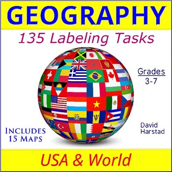
Geography Maps | USA & World Maps | 135 Map Labeling Tasks (Gr. 3-7).
With more labeling than a box of fancy fireworks, these map worksheets bring the world to your classroom. Use map labeling for morning work, homework, or unit transitions. Students learn basic spatial locations of American states, countries, regions, and cities.
- Worksheets work nicely with atlas or internet maps.
- This listing is part of the larger Geography Bundle: Maps, Questions, Labeling.
About the collection:
Maps were compiled from free online sites. Clarity and line quality may vary. Outline in Sharpie for any issues. Worksheets sold "as is". Please check Preview to ensure download meets your standards. The product is for general map fluency and does not include answer keys.
Preview same as Download and includes the following assignments:
USA - PHYSICAL MAP
1. Label six rivers
2. Rocky Mountains, Sierra Nevada, Cascade Mountains, Appalachian Mountains
3. Black Hills (Home of Mt. Rushmore)
4. Great Salt Lake, Great Lakes (Hint: HOMES)
5. Canada, Mexico, The Bahamas
6. Add Hawaii and Alaska
7. Pacific Ocean, Atlantic Ocean, Gulf of Mexico
8. Great Plains, Piedmont, Mojave Desert
9. Washington, D.C. and your school.
10. How long is the Mississippi River?
USA - WEST
1. Label all states
2. Label all capitals
3. Label one large city in each state
4. Columbia River, Colorado River
5. Pacific Ocean
6. Rocky Mountains, Sierra Nevada, Cascade Mountains
7. Great Salt Lake
8. Mojave Desert
9. Great Basin (“water having no connection to the ocean”)
10. Canada, Mexico
USA - MIDWEST
1. Label all states
2. Label all capitals
3. Label one large city in each state
4. Mississippi River
5. Missouri River
6. Ohio River
7. Lake Michigan and Lake Superior
8. Canada
9. Great Plains
USA - SOUTH
1. Label all states
2. Label all capitals
3. Label one large city in each state
4. Mississippi River, Ohio River, Rio Grande River, Red River
5. Atlantic Ocean, Gulf of Mexico
6. Appalachian Mountains, Ozark Mountains
7. Florida marshes
8. Louisiana marshes
9. Washington, D.C.
10. Mexico
USA - NORTHEAST
1. Label all states
2. Label all capitals
3. Label one large city in each state
4. Delaware River
5. Atlantic Ocean
6. Appalachian Mountains
7. Lake Eerie, Lake Ontario
8. Niagara Falls, NY
9. Use the Forest symbol to show Maine is a heavily forested state (83%).
AFRICA
1. Label 30 countries and outline all countries in different colors
2. Label 15 large cities
3. Lake Victoria, Nile River
4. Red Sea, Suez Canal
5. Sahara Desert, Kalahari Desert, Atlas Mountains
6. Equator, Tropic of Cancer, Tropic of Capricorn
7. Cape of Good Hope
ANTARCTICA
1. South Pole, magnetic South Pole
2. McMurdo Station, Palmer Station
3. Ross Ice Shelf
4. Queen Maud Land
5. Weddell Sea, Ross Sea, Amundsen Sea
6. Antarctic Circle
7. Indian Ocean
8. Antarctic Peninsula
9. Transantarctic Mountains
10. Label two more features
ASIA
1. Label 25 countries and outline all countries in different colors
2. Label 20 capitals
3. Pacific Ocean, Indian Ocean, Arctic Ocean
4. Gobi Desert, Ural Mountains, Himalayas
5. Mt. Everest, Caspian Sea, Arabian Desert
6. Yellow River, Ob River, Ganges River
7. Arctic Circle, Tropic of Cancer, Equator
8. Lake Baikal
9. Hong Kong
10. Label two more features
AUSTRALIA
1. Label six states and two territories; outline each in alternating colors
2. Label 10 large cities
3. Ayers Rock, Great Dividing Range, Great Sandy Desert
4. Darling River, Murray River, two lakes
5. Indian Ocean, Pacific Ocean, Tasman Sea, Gulf of Carpentaria
6. Three nearby countries
7. Tropic of Capricorn
8. Canberra
9. Two additional features
EUROPE
1. Label 30 countries and outline all countries in different colors
2. Label 15 large cities
3. Mediterranean Sea, Baltic Sea, Black Sea, Atlantic Ocean (color blue lightly, avoiding your labels)
4. Alps Mountains, Pyrenees Mountains, Ural Mountains
5. Atlantic Ocean, Strait of Gibraltar
MIDDLE EAST
1. Label 20 countries and outline all countries in alternating colors.
2. Label 20 country capitals
3. Nile River, Tigris River, Euphrates River
4. Mediterranean Sea, Black Sea, Caspian Sea
5. Zagros Mountains, Syrian Desert, Suez Canal
6. Persian Gulf, Red Sea, Arabian Sea
7. Lightly color the water blue, avoiding your labels
NORTH AMERICA
1. Label 15 countries and outline in different colors
2. Label 15 large cities
3. Label your school and Washington, D.C.
4. Mississippi River, Yukon River, Rio Grande River
5. Atlantic Ocean, Pacific Ocean, Arctic Ocean
6. Hudson Bay, Caribbean Sea, Gulf of Mexico
7. Rocky Mountains, Mojave Desert
8. Tropic of Cancer, magnetic North Pole
9. Great Bear Lake, Great Lakes (Hint: HOMES)
10. Panama Canal
OCEANIA
1. Label 12 countries; outline all countries in alternating colors
2. Label 10 towns
3. Pacific Ocean, Indian Ocean, Tasman Sea, Coral Sea
4. Equator
5. Great Barrier Reef
6. International Date Line (mathematical line where each new day begins)
7. Tropic of Capricorn
8. Great Australian Bight
9. Two additional features
SOUTH AMERICA
1. Label all countries and outline in different colors
2. Label all capitals
3. Label one large city in each country
4. Amazon River, Atacama Desert, Andes Mountains
5. Atlantic Ocean, Pacific Ocean, Caribbean Sea
6. Cape Horn, Strait of Magellan, Lake Titicaca
7. Amazon Basin
8. Tropic of Capricorn, Equator
9. Pampas (grassland)
10. Patagonia (region)
USA - POLITICAL MAP & FLAG
1. Label all 50 states.
2. Label all state capitals.
3. Label all 15 major U.S. cities.
4. Label Washington, D.C.
5. Outline each state a different color, so that no two same colors are touching.
6. State boundaries were usually decided by a mathematical line or natural boundaries, like mountain ranges or rivers. List three states that contain both line and natural borders.
7. State capitals are not always the largest city. Many states chose smaller cities for their capital to reduce the influence big cities would have over state decisions. List three small-city capitals.
8. What is the second most northern state after Alaska? (Hint: It is not Maine.)
9. The flag should never be used as a drape, towel, tablecloth, sheet, or clothing. Instead, use bunting as a patriotic decoration. What are three different occasions bunting would be an appropriate decoration?
10. A United States flag is provided, at no cost, to families of deceased veterans for memorial services. The purpose is to honor the memory of a veteran’s military service to his or her country. The request form and flags are available at your local post office. How does a memorial flag from the United States show respect to the veteran?
Lay on Ground - Light Fuse - Get Away!
-------------------------------------------------------------------------------------------------------------
And for those of us who like one-stop shopping...
ART
- Art Bundle: Watercolors, Silhouettes, Color Sheets (668 pages)
- Coloring Sheets - 468 Pages
- Illustrations - 21 Math
- Coloring Pages - 56 People
- Coloring Pages - 32 Classical Art
- Silhouette Art: Jefferson Memorial
- Silhouette Art: Statue of Liberty
- Silhouette Art: Pet Dinosaur
AUSTRALIA & CANADA
- Australian Curriculum - 800 Clip Art Images
- Australia - 100 Australian Animals
- Australia - 80 Famous People
- Australia - 40 Aboriginal Images
- Australia - 32 Maps
- Canada Clipart Posters (740 images)
- Canada - 40 maps
- Canada - 2 Projects & 2 Reports (province & country reports, science fair & history fair).
- Canada - 360 Animals (Canada version)
- Canada - 115 Famous People
- Canada Remembrance Day - (60 Images)
BOOKS
- How Sixth Grade Works (for teachers, parents, students)
- Student Teaching Guide A-Z
BUNDLES
- 100 Downloads
- 82 Downloads (most subjects)
- 91 Editing and Proofreading Worksheets + 223 Writing Prompts
- 223 Writing Prompts + Grammar + Geography + Art + Black & Women's History...
- 1,624 US History & US Geography Images + Math + Grammar Worksheets + Reading...
- Back to School Bundle (600 items)
- Classroom Decor Bundle
- End of the Year Activities Bundle
- ESL Worksheets - 33 Products
- First Week Activities - 22 Products
- Geography Bundle (maps, questions, labeling)
- Handwriting Practice for Older Students + 91 Editing Skills + 223 Writing...
- Homework Worksheets (313 Worksheets)
- Fun Friday Activities Bundle
- Language Arts Bundle - Writing, Editing, Reading Comprehension
- Last Week of School Activities - Fun with a little work.
- Lesson Bundles - Centers - Mini Lessons
- Literacy Centers - 36 Products
- Math Bundle - Math Facts - Fractions - Graphic Organizers - Calculator Riddles
- Morning Work Bundle (532 Items)
- Sub Days (595 Items)
- Summer Packet - 525 Assignments
- Summer School Activities (42 Products)
- World Cultures (44 countries, maps, flags, images, labeling)
- Writing Prompts + Map Labeling + Writing Skills + Editing + Reading Comp...
CALENDAR
EDITING & WRITING SKILLS
- Editing Daily Practice (65 sentences)
- Editing & Grammar Bundle (91 Worksheets)
- Editing - 12 Correct & Rewrite Prompts
- Editing - 35 Structured Editing Worksheets
- Writing Skills - 7 Basic Worksheets
- Writing Skills - 27 Intermediate Worksheets
- Writing Skills - 10 Advanced Worksheets
GEOGRAPHY
- Geography Bundle - Landforms - Oceans & Continents
- Geography - 135 Map Labeling Tasks
- Geography - 100 Terms & Definitions
- Geography - Maps, Labeling, Questions
- Landforms - 15 Maps & Worksheets
- Landforms - 96 Flashcards
- Landforms - Basic (flashcards, worksheets, PPT, quiz)
- Landforms - Intermediate (flashcards, worksheets, PPT, quiz)
- Landforms - Advanced (flashcards, worksheets, PPT, quiz)
- Landforms - Project (tri-fold research project)
- Maps - 28 USA
- Maps - 35 World
- Maps - 50 U.S. State Outlines
- Questions - 100 USA Geography
- Questions - 100 World Geography
HOLIDAYS & SEASONAL
- Black History Month Trivia (PPT) (February calendar)
- Black History Month (14 graphic organizers)
- Black History Month - 45 Flashcards
- Christmas - 11 Writing Prompts
- Decor - Holidays & Seasons Clip Art Posters (40)
- Easter Writing - 12 Printable Prompts
- End of the Year Activity (Create-A-City)
- Fall/Autumn - 33 Writing Prompts
- Halloween Writing - 10 Printable Prompts
- Mother's Day "Flowers" - Watercolors Art
- Presidents' Day - 2 Art Activities (White House Floorplan & Jefferson Memorial)
- Valentine's Day - 17 Writing Prompts
- Veterans & Memorial Day - 32 Writing Prompts
- Veterans & Memorial Day: Iwo Jima Silhouette
- Women's History Month (PPT) (March calendar)
- Women's History Month Bulletin Board - 10 Posters
- Spring - 35 Writing Prompts
- Summer - 40 Writing Prompts
- Winter - 33 Writing Prompts
LANGUAGE ARTS
- Handwriting Bundle - 154 Prompts
- Handwriting - 16 Printing Prompts | STEM
- Handwriting - 16 Cursive Prompts | STEM
- Handwriting - 20 Printing Prompts - Fun Facts
- Handwriting - 20 Cursive Writing Prompts - Fun Facts
- Handwriting - 22 Printing Prompts | Leaders & Heroes
- Handwriting - 22 Cursive Writing Prompts | Leaders & Heroes:
- Handwriting - 24 Printing Prompts | Careers
- Handwriting - 24 Cursive Prompts | Careers
- Handwriting - 54 Printing Prompts - USA States
- Handwriting - 54 Cursive Prompts - USA States
- Reading E-book: 185 to Go (The school countdown starts the first day...)
- Reading Comprehension - 20 Fun Facts Worksheets
- Reading Comprehension - 9 Oregon Trail Worksheets
- Speeches - 6 classroom speeches: What to assign & how to grade.
- Spelling - 70 Spelling Lists
- Writing Bundle - 223 Prompts (meets 78% CC Writing standards for grades 3-7)
- Writing - Create A City (where language meets design)
- Writing Ideas - 300 Images
- Writing - 5 Respect the Flag Prompts
- Writing - 6 Abstract Prompts
- Writing - 8 Historical WWII Prompts
- Writing - 17 Persuasive Prompts
- Writing - 18 Suspense Prompts
- Writing - 18 Non-Fiction Prompts
- Writing - 20 Dialogue Prompts
- Writing - 22 Reporting Prompts
- Writing - 25 Irony Prompts
- Writing - 30 Expository Prompts
- Writing - 33 Humor Prompts
- Writing - 180 Prompts with Pictures (PowerPoint)
MATH
- Bundle - (math facts, fractions, graphic organizers, calculator riddles)
- Addition & Subtraction (20 worksheets)
- Calculator - 90 Riddles
- Bingo - 7 Themes
- Emergency Sub Plans for Math (62 worksheets)
- Math Facts - Flashcards
- Math Facts - 25 Fluency Timed Tests
- Math Paper - 52 Types
- Fractions - 39 Worksheets
- Fractions Bundle
- Multiplication & Division (18 worksheets)
- Numbers: 100 Flashcards Heroes & Leaders
- Number Sense Bundle (150 products)
- Place Value - 6 worksheets
- Presidents - 45 President Flashcards
REPORTS & PROJECTS
SCIENCE
- Classify Animals (88 animal silhouettes & worksheet)
- Dinosaurs (14 Graphic Organizers)
- Oceans & Continents (animals, maps, map labeling)
- Oceans & Coast (flashcards & images)
- Science Bundle - Animals, Worksheets, Graphic Organizers, STEM Handwriting
- Science - 20 Random Worksheets
- Science - 10 Mythbusters Lab Reports (also works with any internet experiment)
- Zoo Animals (360 images & art )
SOCIAL STUDIES
- Bundle - US History & US Geography
- US Presidents w/ 12 Graphic Organizers
- State Report with Project and Speech - assignment sheet
- Texas & USA Bundle
- USA States - 1,624 Images (Maps, Flags, Past & Present)
- USA Regions (maps, images, questions, labeling, state report)
- USA - Clip Art & Posters - 724 Images
- USA - Clip Art & Posters - 1,366 Images & Illustrations
- USA - Heroes & Leaders Images (165)
- USA - 1700's - Colonies & Revolution Images (31)
- USA - 1800's - Events & Monuments Images (45)
- USA - 1900's - Progress & Determination Images (60)
- USA - 2000's - Life & Liberty Images (56)
- USA - Presidents & White House Images (120)
- USA - Apollo 11 - Images (20)
- USA - Vintage War Posters (37)
- Veterans & Memorial Day Bulletin Board Ideas (28)
SPECIAL EDUCATION
- Special Education Bundle (writing, editing, math, reading, geography, US history)
- Writing Activities for Special Education
- Language Arts Bundle for Special Education
- Writing for Struggling Writers - Bundle
- Geography for Special Education (images, maps & labeling, questions...)
- Math for Special Education
- US History for Special Education
WEBQUESTS
OTHER
- Bulletin Board Ideas for a Year (47 products)
- Clip Art - 200 Borders & Frames - for teachers & sellers.
- Clip Art - 300 Colors & Backgrounds - for teachers & sellers.
- Clip Art - 525 Accessories - for teachers & sellers.
- Emergency Sub Plans (310 Worksheets)
- Fonts - 510 Commercial Free Fonts
- Paper Bundle - 62 Types
- 42 Awards (editable & certificates)
- Student Teacher Bundle (842 items)
- Sunday School - 150 Coloring Sheets
Return to The Harstad Collection.

